Area Overview for CH7 6FP
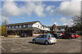
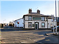
Photos of CH7 6FP
Area Information
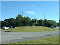
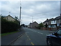
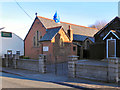
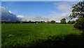
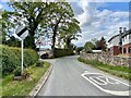
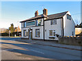
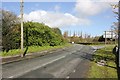
CH7 6FP is a small residential cluster in Flintshire, Wales, nestled in a rural setting with a population of 1,561. Its low density of 156 people per square kilometre reflects a quiet, spread-out character, typical of villages with historical roots. Located approximately 12 miles west of Chester, the area lies midway between Mold and Flint, just off junction 33 of the A55 North Wales Expressway. This strategic crossroads position has shaped its identity, linking it to ancient Roman and medieval trade routes. The village of Northop, which includes Sychdyn and parts of former Connah’s Quay, retains a rural essence despite 20th-century post-war expansion. Residents benefit from proximity to historical landmarks like the Grade I-listed Church of St Eurgain and St Peter, as well as preserved sections of 8th-century Wat’s Dyke. Daily life here balances traditional village charm with modern convenience, supported by nearby amenities and transport links. The area’s character is defined by its strategic location, historical significance, and the enduring presence of rural landscapes.
- Area Type
- Postcode
- Area Size
- Not available
- Population
- 1561
- Population Density
- 156 people/km²
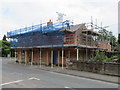
CH7 6FP is a small, owner-occupied area where 80% of homes are owned by residents rather than rented. The accommodation type is predominantly houses, which is typical of rural and semi-rural communities in Wales. This suggests a housing stock that is largely traditional, with fewer high-density developments or modern apartments. The limited size of the area means that property availability is constrained, and buyers should consider the proximity to nearby towns like Mold and Flint for more options. The high home ownership rate indicates a stable market where properties are likely to remain in private hands for extended periods. For buyers, this means a focus on individual homes rather than rental properties, with potential for long-term value retention. The rural character of the area also means that properties may blend traditional architecture with modern amenities, appealing to those seeking a quieter lifestyle. However, the small size of CH7 6FP means that the immediate surroundings, rather than the area itself, may hold more diversity in housing stock.
House Prices in CH7 6FP
No properties found in this postcode.
Energy Efficiency in CH7 6FP
Living in CH7 6FP offers a blend of rural tranquillity and practical amenities. Within practical reach are five retail outlets, including Sainsburys Mold, Lidl Mold, and Iceland Mold, providing everyday shopping convenience. The area’s rail network includes five nearby stations, such as Buckley and Hawarden, offering access to regional transport and commuting opportunities. Hawarden Airport, just a short distance away, adds to the area’s connectivity. For leisure, the historical and natural features of the parish—such as the preserved section of Wat’s Dyke and the Grade I-listed Church of St Eurgain—offer cultural and recreational value. The rural character means open spaces and a slower pace of life, though residents may need to travel to larger towns for more extensive dining or entertainment options. The combination of local shops, transport links, and historical sites creates a lifestyle that balances self-sufficiency with access to broader opportunities.
Amenities
Schools
The nearest school to CH7 6FP is Ysgol Owen Jones C.P., a primary school listed as an “other” type in the data. No specific Ofsted rating is provided, but its presence suggests that the area is served by at least one educational institution catering to younger children. The school’s location within practical reach of residents means families can access schooling without long commutes. However, the data does not include information on secondary schools or additional educational facilities, so prospective homebuyers may need to consider the availability of further education options in nearby towns like Mold or Chester. The mix of school types is limited here, but the presence of a primary school supports families with young children. For those prioritising a range of educational choices, exploring nearby areas or commuting to larger centres may be necessary.
| Rank | School | Type | Entry gender | Ages |
|---|
Explore more schools in this area
Go to Schools tabDemographics
The population of CH7 6FP has a median age of 47, with the majority of residents falling within the 30-64 age range. This suggests a mature, stable community with a strong presence of working-age adults. Home ownership is high at 80%, indicating a predominantly owner-occupied area where most residents live in their own homes. The accommodation type is primarily houses, reflecting a more traditional housing stock rather than flats or apartments. The predominant ethnic group is White, which aligns with broader trends in rural Wales. While the data does not provide specific information on deprivation levels, the high home ownership rate and age profile suggest a community with established roots and a focus on long-term residency. The absence of detailed diversity metrics means the area’s demographic makeup is likely homogeneous, though this does not necessarily indicate a lack of inclusivity. The population density, combined with the age distribution, points to a low-pressure environment where families and older residents coexist in a quiet, rural setting.
Household Size
Accommodation Type
Tenure
Ethnic Group
Religion
Household Composition
Age
Household Deprivation
NS-SEC
Explore more demographic insights in this area
Go to Demographics tabPlanning
Planning Constraints
- Flood RiskPremium
- Ramsar Wetland SitesPremium
- Area of Outstanding Natural BeautyPremium
- Protected Nature ReservePremium
- Protected WoodlandPremium
- Crime RiskPremium