Area Overview for CH7 6AQ
Photos of CH7 6AQ
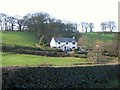
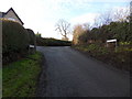
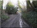
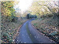
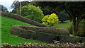
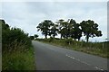
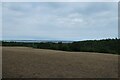
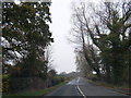
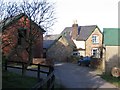
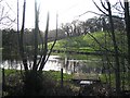
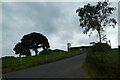
11 photos from this area
Area Information
Key information about the CH7 6AQ including its size, population, and administrative classification.
- Area Type
- Postcode
- Area Size
- 65.2 hectares
- Population
- 1717
- Population Density
- 68 people/km²
House Prices in CH7 6AQ
7
Properties
£469,250
Average Sold Price
£112,000
Lowest Price
£725,000
Highest Price
Showing 7 properties
| Address | Type | Beds | Baths | Last Sale Price | Last Sale Date | |
|---|---|---|---|---|---|---|
| Bryn Glas, Smithy Junction To Jamaica Junction, Halkyn, CH7 6AQ | Detached | 5 | 3 | £725,000 | Nov 2023 | |
| Afon Gonwy Cottage, Smithy Junction To Jamaica Junction, Halkyn, CH7 6AQ | Detached | 3 | 1 | £610,000 | Apr 2023 | |
| Bryn Eithin Cottage, Plas Newydd Farm Junction To Middle Mill Junction, Halkyn, CH7 6AQ | house | - | - | £430,000 | Sep 2012 | |
| Dee View, Plas Newydd Farm Junction To Middle Mill Junction, Halkyn, CH7 6AQ | house | - | - | £112,000 | Feb 1995 | |
| Middle Mill, The Green Junction To Middle Mill Junction, Northop, CH7 6AQ | Detached | 3 | 3 | - | - | |
| Bryn Eithin Farm, Middle Mill Junction To Little Chef Roundabout Old A 55, Halkyn, CH7 6AQ | Detached | - | - | - | - | |
| Jamaica Cottage, Smithy Junction To Jamaica Junction, Halkyn, CH7 6AQ | Detached | - | - | - | - |
Energy Efficiency in CH7 6AQ
Amenities
Schools
| Rank | School | Type | Entry gender | Ages |
|---|
Explore more schools in this area
Go to Schools tabDemographics
Household Size
Two person
most common
Accommodation Type
Houses
most common
Tenure
81
majority
Ethnic Group
White
most common
Religion
N/A
most common
Household Composition
N/A
most common
Age
47
median
Adults (30-64 years)
most common
Household Deprivation
N/A
with no deprivation
NS-SEC
39
in Lower managerial occupations
Explore more demographic insights in this area
Go to Demographics tabPlanning
Planning Constraints
- Flood RiskPremium
- Ramsar Wetland SitesPremium
- Area of Outstanding Natural BeautyPremium
- Protected Nature ReservePremium
- Protected WoodlandPremium
- Crime RiskPremium