Area Overview for CH7 4TU
Photos of CH7 4TU
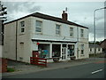
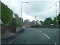

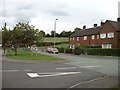
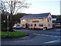
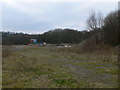
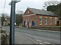
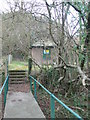
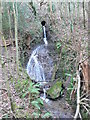
13 photos from this area
Area Information
Key information about the CH7 4TU including its size, population, and administrative classification.
- Area Type
- Postcode
- Area Size
- 1.8 km²
- Population
- 1878
- Population Density
- 96 people/km²
House Prices in CH7 4TU
32
Properties
£322,375
Average Sold Price
£142,000
Lowest Price
£485,000
Highest Price
Showing 32 properties
| Address | Type | Beds | Baths | Last Sale Price | Last Sale Date | |
|---|---|---|---|---|---|---|
| Nant Y Fron, Woodside Cottage Junction A 5104, Pontybodkin, CH7 4TU | Detached | 3 | 2 | £310,000 | Dec 2022 | |
| Emmervale, Tir Y Fron Lane, Pontybodkin, CH7 4TU | Detached | 4 | 2 | £485,000 | Jan 2020 | |
| Isfryn Farm, Tir Y Fron Lane, Pontybodkin, CH7 4TU | Detached | 3 | 1 | £352,500 | Dec 2018 | |
| Rose Cottage, Tir Y Fron Lane, Pontybodkin, CH7 4TU | Detached | - | - | £142,000 | Dec 2000 | |
| Chester View, Tir Y Fron Lane, Pontybodkin, CH7 4TU | Detached | 5 | 3 | - | - | |
| Stable Cottage, Tir Y Fron Lane, Pontybodkin, CH7 4TU | Cottage | 2 | 2 | - | - | |
| Bwythyn, Tir Y Fron Lane, Pontybodkin, CH7 4TU | Detached | - | - | - | - | |
| Flat, Tri Thy, Tir Y Fron Lane, Pontybodkin, CH7 4TU | Flat | - | - | - | - | |
| Hillside Cottage, Tir Y Fron Lane, Pontybodkin, CH7 4TU | Detached | - | - | - | - | |
| Bryn Awel, Tir Y Fron Lane, Pontybodkin, CH7 4TU | Detached | - | - | - | - |
Page 1 of 4
Energy Efficiency in CH7 4TU
Amenities
Schools
| Rank | School | Type | Entry gender | Ages |
|---|
Explore more schools in this area
Go to Schools tabDemographics
Household Size
Two person
most common
Accommodation Type
Houses
most common
Tenure
84
majority
Ethnic Group
White
most common
Religion
N/A
most common
Household Composition
N/A
most common
Age
47
median
Adults (30-64 years)
most common
Household Deprivation
N/A
with no deprivation
NS-SEC
39
in Lower managerial occupations
Explore more demographic insights in this area
Go to Demographics tabPlanning
Planning Constraints
- Flood RiskPremium
- Ramsar Wetland SitesPremium
- Area of Outstanding Natural BeautyPremium
- Protected Nature ReservePremium
- Protected WoodlandPremium
- Crime RiskPremium