Area Overview for CH7 4HB
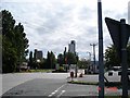
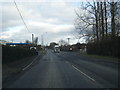
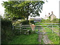
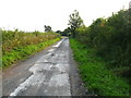
Photos of CH7 4HB

Area Information
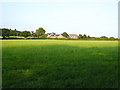
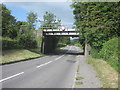
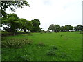
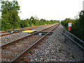
Living in CH7 4HB, a small residential cluster in Flintshire, Wales, offers a compact, tightly knit community within a 40.2-hectare area. With a population of 1,672 people, the area has a population density of 634 people per square kilometre, reflecting a balance between residential density and open space. Situated in Buckley, a historic town with roots tracing back to 1294, the area benefits from its proximity to local heritage sites and industrial history, including 18th-century pottery and coal-mining legacies. Daily life here is shaped by its proximity to rail networks, with five stations within reach, including Penyffordd and Buckley stations, offering easy access to nearby towns. The area’s character is defined by its mix of traditional housing and modern amenities, with a median age of 47 and a population skewed toward adults aged 30–64. This suggests a community rooted in stability, with many residents likely to be homeowners, given the 57% home ownership rate.
- Area Type
- Postcode
- Area Size
- 40.2 hectares
- Population
- 1672
- Population Density
- 634 people/km²
The property market in CH7 4HB is characterised by a high proportion of owner-occupied homes, with 57% of households owning their properties. The accommodation type is predominantly houses, which is typical for smaller, residential clusters where larger family homes are common. This suggests a market that caters more to long-term residents than to renters, though the area’s small size means the housing stock is limited. Buyers should consider that the area is not a rental hotspot, which may affect availability for those seeking short-term accommodation. The focus on houses also implies that properties here are likely to be more spacious than in high-density urban areas, though the limited land area means development options are constrained. Prospective buyers should also note that the area’s proximity to rail networks and historical sites may appeal to those prioritising location over property size.
House Prices in CH7 4HB
No properties found in this postcode.
Energy Efficiency in CH7 4HB
Residents of CH7 4HB have access to a range of local amenities within practical reach. Retail options include Spar, Co-op Penyffordd, and Aldi Nant, providing everyday shopping convenience. The area’s rail network, with stations such as Buckley and Hope, ensures easy access to nearby towns and services. For travel, Hawarden Airport is a short distance away, offering regional and domestic flight connections. The presence of multiple retail outlets and transport hubs suggests a lifestyle that balances local convenience with broader connectivity. While the area’s small size means it lacks large-scale leisure facilities, its proximity to Buckley’s historic sites, including churches and heritage trails, offers cultural and recreational opportunities. This blend of practical amenities and historical character defines the daily rhythm of life in CH7 4HB.
Amenities
Schools
| Rank | School | Type | Entry gender | Ages |
|---|
Explore more schools in this area
Go to Schools tabDemographics
The demographic profile of CH7 4HB is defined by its median age of 47, with the majority of residents falling within the 30–64 age range. This suggests a community of established professionals and families, with fewer young people or retirees compared to other areas. Home ownership is strong here, with 57% of households owning their homes, and the predominant accommodation type is houses, reflecting a more traditional, family-oriented housing stock. The population is predominantly White, with no specific data on other ethnic groups provided. The area’s population density of 634 people per square kilometre indicates a moderately compact settlement, which may contribute to a sense of community cohesion. However, the lack of detailed diversity data means the full scope of cultural or social dynamics remains unexplored.
Household Size
Accommodation Type
Tenure
Ethnic Group
Religion
Household Composition
Age
Household Deprivation
NS-SEC
Explore more demographic insights in this area
Go to Demographics tabPlanning
Planning Constraints
- Flood RiskPremium
- Ramsar Wetland SitesPremium
- Area of Outstanding Natural BeautyPremium
- Protected Nature ReservePremium
- Protected WoodlandPremium
- Crime RiskPremium