Area Overview for CH7 3NH
Photos of CH7 3NH
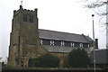
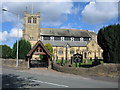
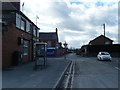
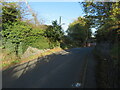
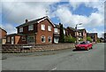
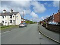

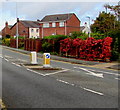
14 photos from this area
Area Information
Key information about the CH7 3NH including its size, population, and administrative classification.
- Area Type
- Postcode
- Area Size
- 3.1 hectares
- Population
- 1656
- Population Density
- 1570 people/km²
House Prices in CH7 3NH
44
Properties
£181,609
Average Sold Price
£42,000
Lowest Price
£437,500
Highest Price
Showing 44 properties
| Address | Type | Beds | Baths | Last Sale Price | Last Sale Date | |
|---|---|---|---|---|---|---|
| 40 Tram Road, Buckley, CH7 3NH | Bungalow | 2 | 1 | £215,000 | Jun 2025 | |
| 1 Tram Road, Buckley, CH7 3NH | Bungalow | 2 | 1 | £310,000 | May 2025 | |
| 56 Tram Road, Buckley, CH7 3NH | house | - | - | £437,500 | Mar 2021 | |
| 19 Tram Road, Buckley, CH7 3NH | house | - | - | £240,000 | Aug 2019 | |
| 44 Tram Road, Buckley, CH7 3NH | Bungalow | - | - | £258,500 | Jul 2019 | |
| 10 Tram Road, Buckley, CH7 3NH | Semi-detached | 3 | 2 | £148,000 | May 2019 | |
| 23 Tram Road, Buckley, CH7 3NH | Detached | 4 | 1 | £238,000 | Oct 2015 | |
| 29 Tram Road, Buckley, CH7 3NH | Bungalow | 3 | 2 | £200,000 | Sep 2014 | |
| 52 Tram Road, Buckley, CH7 3NH | Bungalow | 2 | 2 | £207,000 | Jul 2014 | |
| 31 Tram Road, Buckley, CH7 3NH | house | - | - | £225,000 | Jun 2014 |
Page 1 of 5
Energy Efficiency in CH7 3NH
Amenities
Schools
| Rank | School | Type | Entry gender | Ages |
|---|
Explore more schools in this area
Go to Schools tabDemographics
Household Size
Two person
most common
Accommodation Type
Houses
most common
Tenure
89
majority
Ethnic Group
White
most common
Religion
N/A
most common
Household Composition
N/A
most common
Age
47
median
Adults (30-64 years)
most common
Household Deprivation
N/A
with no deprivation
NS-SEC
42
in Lower managerial occupations
Explore more demographic insights in this area
Go to Demographics tabPlanning
Planning Constraints
- Flood RiskPremium
- Ramsar Wetland SitesPremium
- Area of Outstanding Natural BeautyPremium
- Protected Nature ReservePremium
- Protected WoodlandPremium
- Crime RiskPremium