Area Overview for CH7 2EF
Photos of CH7 2EF
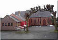


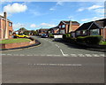


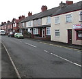

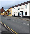
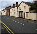
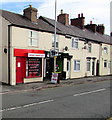
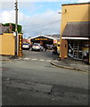
100 photos from this area
Area Information
Key information about the CH7 2EF including its size, population, and administrative classification.
- Area Type
- Postcode
- Area Size
- 3.5 hectares
- Population
- 1672
- Population Density
- 634 people/km²
House Prices in CH7 2EF
27
Properties
£163,181
Average Sold Price
£86,500
Lowest Price
£267,000
Highest Price
Showing 27 properties
| Address | Type | Beds | Baths | Last Sale Price | Last Sale Date | |
|---|---|---|---|---|---|---|
| The Orchards, Brunswick Road, Buckley, CH7 2EF | Detached | - | - | £267,000 | Jan 2022 | |
| 34 Brunswick Road, Buckley, CH7 2EF | Semi-detached | 3 | 1 | £160,000 | Sep 2021 | |
| 28 Brunswick Road, Buckley, CH7 2EF | Semi-detached | 3 | - | £145,000 | Jun 2021 | |
| Oakfield House, Brunswick Road, Buckley, CH7 2EF | Detached | 3 | 1 | £225,000 | Aug 2017 | |
| Edensor, Brunswick Road, Buckley, CH7 2EF | Detached | 4 | 2 | £232,000 | May 2015 | |
| 36 Brunswick Road, Buckley, CH7 2EF | house | - | - | £95,000 | Aug 2004 | |
| 30 Brunswick Road, Buckley, CH7 2EF | house | - | - | £94,950 | Aug 2002 | |
| 32 Brunswick Road, Buckley, CH7 2EF | Detached | - | - | £86,500 | Mar 1999 | |
| 4B Brunswick Road, Buckley, CH7 2EF | Flat | - | - | - | - | |
| Flat, 10 Brunswick Road, Buckley, CH7 2EF | Flat | - | - | - | - |
Page 1 of 3
Energy Efficiency in CH7 2EF
Amenities
Schools
| Rank | School | Type | Entry gender | Ages |
|---|
Explore more schools in this area
Go to Schools tabDemographics
Household Size
One person
most common
Accommodation Type
Houses
most common
Tenure
57
majority
Ethnic Group
White
most common
Religion
N/A
most common
Household Composition
N/A
most common
Age
47
median
Adults (30-64 years)
most common
Household Deprivation
N/A
with no deprivation
NS-SEC
26
in Lower managerial occupations
Explore more demographic insights in this area
Go to Demographics tabPlanning
Planning Constraints
- Flood RiskPremium
- Ramsar Wetland SitesPremium
- Area of Outstanding Natural BeautyPremium
- Protected Nature ReservePremium
- Protected WoodlandPremium
- Crime RiskPremium