Area Overview for CH7 1LT
Photos of CH7 1LT
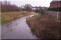
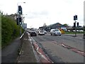
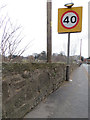
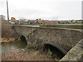
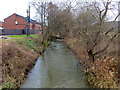
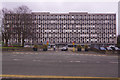
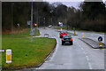
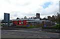
20 photos from this area
Area Information
Key information about the CH7 1LT including its size, population, and administrative classification.
- Area Type
- Postcode
- Area Size
- 10.3 hectares
- Population
- 1958
- Population Density
- 845 people/km²
House Prices in CH7 1LT
42
Properties
£261,958
Average Sold Price
£35,000
Lowest Price
£520,000
Highest Price
Showing 42 properties
| Address | Type | Beds | Baths | Last Sale Price | Last Sale Date | |
|---|---|---|---|---|---|---|
| 57 Bryn Awelon, Mold, CH7 1LT | house | - | - | £520,000 | Feb 2023 | |
| 53 Bryn Awelon, Mold, CH7 1LT | Bungalow | 3 | 1 | £273,000 | Feb 2022 | |
| 1 Bryn Awelon, Mold, CH7 1LT | house | - | - | £420,000 | Nov 2021 | |
| 25 Bryn Awelon, Mold, CH7 1LT | house | - | - | £330,000 | Nov 2021 | |
| Lyndhurst, 39 Bryn Awelon, Mold, CH7 1LT | Detached | 5 | - | £317,500 | Jun 2021 | |
| The Conifers, 81 Bryn Awelon, Mold, CH7 1LT | Detached | 4 | 4 | £300,000 | Jan 2020 | |
| Efrog, 13 Bryn Awelon, Mold, CH7 1LT | house | - | - | £325,000 | Nov 2019 | |
| 89 Bryn Awelon, Mold, CH7 1LT | Detached | 3 | - | £310,000 | Nov 2019 | |
| Gronfoel, 21 Bryn Awelon, Mold, CH7 1LT | house | - | - | £250,000 | Sep 2018 | |
| 29 Bryn Awelon, Mold, CH7 1LT | house | - | - | £235,000 | Jul 2018 |
Page 1 of 5
Energy Efficiency in CH7 1LT
Amenities
Schools
| Rank | School | Type | Entry gender | Ages |
|---|
Explore more schools in this area
Go to Schools tabDemographics
Household Size
Two person
most common
Accommodation Type
Houses
most common
Tenure
69
majority
Ethnic Group
White
most common
Religion
N/A
most common
Household Composition
N/A
most common
Age
47
median
Adults (30-64 years)
most common
Household Deprivation
N/A
with no deprivation
NS-SEC
33
in Lower managerial occupations
Explore more demographic insights in this area
Go to Demographics tabPlanning
Planning Constraints
- Flood RiskPremium
- Ramsar Wetland SitesPremium
- Area of Outstanding Natural BeautyPremium
- Protected Nature ReservePremium
- Protected WoodlandPremium
- Crime RiskPremium