Area Overview for CH5 4QN
Photos of CH5 4QN

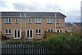
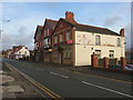
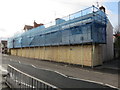


100 photos from this area
Area Information
Key information about the CH5 4QN including its size, population, and administrative classification.
- Area Type
- Postcode
- Area Size
- 8943 m²
- Population
- 1918
- Population Density
- 570 people/km²
House Prices in CH5 4QN
34
Properties
£100,448
Average Sold Price
£4,000
Lowest Price
£181,000
Highest Price
Showing 34 properties
| Address | Type | Beds | Baths | Last Sale Price | Last Sale Date | |
|---|---|---|---|---|---|---|
| 46A Mold Road, Connahs Quay, CH5 4QN | Retail | - | - | £85,000 | Mar 2024 | |
| 16 Mold Road, Connahs Quay, CH5 4QN | house | - | - | £170,000 | Apr 2023 | |
| 36 Mold Road, Connahs Quay, CH5 4QN | house | - | - | £170,000 | Jan 2023 | |
| 26 Mold Road, Connahs Quay, CH5 4QN | house | - | - | £181,000 | Oct 2022 | |
| 14 Mold Road, Connahs Quay, CH5 4QN | Terraced | 3 | - | £140,000 | Dec 2021 | |
| 54 Mold Road, Connahs Quay, CH5 4QN | house | - | - | £100,000 | Sep 2021 | |
| 58 Mold Road, Connahs Quay, CH5 4QN | Detached | 4 | 2 | £165,000 | Sep 2019 | |
| 42 Mold Road, Connahs Quay, CH5 4QN | house | 3 | 1 | £120,000 | Jun 2019 | |
| 52 Mold Road, Connahs Quay, CH5 4QN | Terraced | 3 | 2 | £145,000 | May 2017 | |
| 48 Mold Road, Connahs Quay, CH5 4QN | Terraced | 4 | 2 | £92,000 | Jan 2015 |
Page 1 of 4
Energy Efficiency in CH5 4QN
Amenities
Schools
| Rank | School | Type | Entry gender | Ages |
|---|
Explore more schools in this area
Go to Schools tabDemographics
Household Size
One person
most common
Accommodation Type
Houses
most common
Tenure
40
majority
Ethnic Group
White
most common
Religion
N/A
most common
Household Composition
N/A
most common
Age
47
median
Adults (30-64 years)
most common
Household Deprivation
N/A
with no deprivation
NS-SEC
14
in Lower managerial occupations
Explore more demographic insights in this area
Go to Demographics tabPlanning
Planning Constraints
- Flood RiskPremium
- Ramsar Wetland SitesPremium
- Area of Outstanding Natural BeautyPremium
- Protected Nature ReservePremium
- Protected WoodlandPremium
- Crime RiskPremium