Area Overview for CH5 4JN
Photos of CH5 4JN

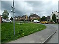
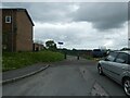
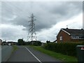
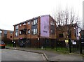

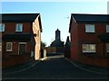
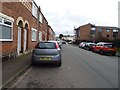
15 photos from this area
Area Information
Key information about the CH5 4JN including its size, population, and administrative classification.
- Area Type
- Postcode
- Area Size
- 1.6 hectares
- Population
- 1187
- Population Density
- 183 people/km²
House Prices in CH5 4JN
46
Properties
£108,475
Average Sold Price
£38,000
Lowest Price
£195,000
Highest Price
Showing 46 properties
| Address | Type | Beds | Baths | Last Sale Price | Last Sale Date | |
|---|---|---|---|---|---|---|
| 38 Tecwyn Drive, Connahs Quay, CH5 4JN | house | 3 | 2 | £195,000 | Sep 2024 | |
| 45 Tecwyn Drive, Connahs Quay, CH5 4JN | house | - | - | £165,000 | May 2024 | |
| 40 Tecwyn Drive, Connahs Quay, CH5 4JN | Semi-detached | 3 | 1 | £155,000 | Sep 2021 | |
| 43 Tecwyn Drive, Connahs Quay, CH5 4JN | Semi-detached | 3 | 1 | £150,000 | Aug 2021 | |
| 25 Tecwyn Drive, Connahs Quay, CH5 4JN | house | - | - | £121,000 | Sep 2019 | |
| 6 Tecwyn Drive, Connahs Quay, CH5 4JN | Semi-detached | 3 | 1 | £125,000 | Feb 2019 | |
| 44 Tecwyn Drive, Connahs Quay, CH5 4JN | house | - | - | £145,000 | Apr 2018 | |
| 27 Tecwyn Drive, Connahs Quay, CH5 4JN | Semi-detached | 2 | 1 | £114,000 | Jun 2016 | |
| 2 Tecwyn Drive, Connahs Quay, CH5 4JN | Semi-detached | 3 | - | £123,500 | Mar 2016 | |
| 17 Tecwyn Drive, Connahs Quay, CH5 4JN | house | - | - | £110,000 | Nov 2015 |
Page 1 of 5
Energy Efficiency in CH5 4JN
Amenities
Schools
| Rank | School | Type | Entry gender | Ages |
|---|
Explore more schools in this area
Go to Schools tabDemographics
Household Size
Two person
most common
Accommodation Type
Houses
most common
Tenure
80
majority
Ethnic Group
White
most common
Religion
N/A
most common
Household Composition
N/A
most common
Age
47
median
Adults (30-64 years)
most common
Household Deprivation
N/A
with no deprivation
NS-SEC
24
in Lower managerial occupations
Explore more demographic insights in this area
Go to Demographics tabPlanning
Planning Constraints
- Flood RiskPremium
- Ramsar Wetland SitesPremium
- Area of Outstanding Natural BeautyPremium
- Protected Nature ReservePremium
- Protected WoodlandPremium
- Crime RiskPremium