Area Overview for CH5 4DH
Photos of CH5 4DH
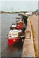
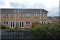
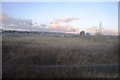
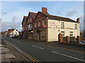
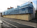
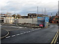
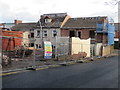
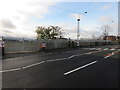
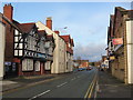
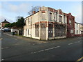
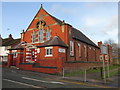

100 photos from this area
Area Information
Key information about the CH5 4DH including its size, population, and administrative classification.
- Area Type
- Postcode
- Area Size
- 3501 m²
- Population
- 1918
- Population Density
- 570 people/km²
House Prices in CH5 4DH
23
Properties
£68,654
Average Sold Price
£32,500
Lowest Price
£115,000
Highest Price
Showing 23 properties
| Address | Type | Beds | Baths | Last Sale Price | Last Sale Date | |
|---|---|---|---|---|---|---|
| 248 High Street, Connahs Quay, CH5 4DH | Terraced | 3 | - | £56,000 | May 2023 | |
| 250 High Street, Connahs Quay, CH5 4DH | Terraced | 2 | 1 | £105,000 | Oct 2022 | |
| 196 High Street, Connahs Quay, CH5 4DH | house | - | - | £94,000 | Sep 2021 | |
| 198 High Street, Connahs Quay, CH5 4DH | house | - | - | £95,000 | Jan 2021 | |
| 192 High Street, Connahs Quay, CH5 4DH | house | - | - | £69,000 | Jan 2021 | |
| 190 High Street, Connahs Quay, CH5 4DH | house | - | - | £70,000 | Sep 2020 | |
| 204 High Street, Connahs Quay, CH5 4DH | house | - | - | £115,000 | Oct 2019 | |
| 202 High Street, Connahs Quay, CH5 4DH | house | 2 | - | £53,000 | Nov 2012 | |
| 244 High Street, Connahs Quay, CH5 4DH | house | 3 | - | £60,000 | Nov 2009 | |
| 222 High Street, Connahs Quay, CH5 4DH | Flat | - | - | £68,000 | Oct 2006 |
Page 1 of 3
Energy Efficiency in CH5 4DH
Amenities
Schools
| Rank | School | Type | Entry gender | Ages |
|---|
Explore more schools in this area
Go to Schools tabDemographics
Household Size
One person
most common
Accommodation Type
Houses
most common
Tenure
40
majority
Ethnic Group
White
most common
Religion
N/A
most common
Household Composition
N/A
most common
Age
47
median
Adults (30-64 years)
most common
Household Deprivation
N/A
with no deprivation
NS-SEC
14
in Lower managerial occupations
Explore more demographic insights in this area
Go to Demographics tabPlanning
Planning Constraints
- Flood RiskPremium
- Ramsar Wetland SitesPremium
- Area of Outstanding Natural BeautyPremium
- Protected Nature ReservePremium
- Protected WoodlandPremium
- Crime RiskPremium