Area Overview for CH5 3JZ
Photos of CH5 3JZ
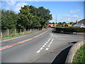
9 photos from this area
Area Information
Key information about the CH5 3JZ including its size, population, and administrative classification.
- Area Type
- Postcode
- Area Size
- 5.8 hectares
- Population
- 1596
- Population Density
- 750 people/km²
House Prices in CH5 3JZ
20
Properties
£214,995
Average Sold Price
£85,000
Lowest Price
£285,000
Highest Price
Showing 20 properties
| Address | Type | Beds | Baths | Last Sale Price | Last Sale Date | |
|---|---|---|---|---|---|---|
| 21 Hazelwood Crescent, Hawarden, CH5 3JZ | Detached | 3 | - | £285,000 | Sep 2021 | |
| 19 Hazelwood Crescent, Hawarden, CH5 3JZ | Detached | 4 | 2 | £285,000 | Mar 2019 | |
| 10 Hazelwood Crescent, Hawarden, CH5 3JZ | house | - | - | £269,000 | May 2017 | |
| 4 Hazelwood Crescent, Hawarden, CH5 3JZ | house | - | - | £270,000 | Sep 2014 | |
| 14 Hazelwood Crescent, Hawarden, CH5 3JZ | Bungalow | 3 | 1 | £259,950 | May 2013 | |
| 7 Hazelwood Crescent, Hawarden, CH5 3JZ | Detached | - | - | £275,000 | Jul 2009 | |
| 6 Hazelwood Crescent, Hawarden, CH5 3JZ | Detached | - | - | £225,000 | Sep 2007 | |
| 18 Hazelwood Crescent, Hawarden, CH5 3JZ | Detached | - | - | £108,000 | Aug 2005 | |
| 16 Hazelwood Crescent, Hawarden, CH5 3JZ | Detached | - | - | £85,000 | Apr 1998 | |
| 2 Hazelwood Crescent, Hawarden, CH5 3JZ | Detached | - | - | £88,000 | Aug 1996 |
Page 1 of 2
Energy Efficiency in CH5 3JZ
Amenities
Schools
| Rank | School | Type | Entry gender | Ages |
|---|
Explore more schools in this area
Go to Schools tabDemographics
Household Size
Two person
most common
Accommodation Type
Houses
most common
Tenure
91
majority
Ethnic Group
White
most common
Religion
N/A
most common
Household Composition
N/A
most common
Age
47
median
Adults (30-64 years)
most common
Household Deprivation
N/A
with no deprivation
NS-SEC
45
in Lower managerial occupations
Explore more demographic insights in this area
Go to Demographics tabPlanning
Planning Constraints
- Flood RiskPremium
- Ramsar Wetland SitesPremium
- Area of Outstanding Natural BeautyPremium
- Protected Nature ReservePremium
- Protected WoodlandPremium
- Crime RiskPremium