Area Overview for CH5 3JR
Photos of CH5 3JR
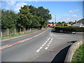
9 photos from this area
Area Information
Key information about the CH5 3JR including its size, population, and administrative classification.
- Area Type
- Postcode
- Area Size
- 4.7 hectares
- Population
- 1727
- Population Density
- 2035 people/km²
House Prices in CH5 3JR
59
Properties
£241,927
Average Sold Price
£75,000
Lowest Price
£505,000
Highest Price
Showing 59 properties
| Address | Type | Beds | Baths | Last Sale Price | Last Sale Date | |
|---|---|---|---|---|---|---|
| 2, Fernbank, Level Road, Hawarden, CH5 3JR | Semi-detached | 3 | 1 | £321,500 | May 2025 | |
| Bluebells, Level Road, Hawarden, CH5 3JR | house | - | - | £235,000 | Feb 2022 | |
| Westfields, Level Road, Hawarden, CH5 3JR | Detached | 4 | 2 | £375,000 | Jan 2022 | |
| Appleton House, Level Road, Hawarden, CH5 3JR | house | - | - | £265,500 | Jan 2022 | |
| Orchard Grange, Level Road, Hawarden, CH5 3JR | house | - | - | £453,000 | Dec 2021 | |
| Nythfa, Level Road, Hawarden, CH5 3JR | Bungalow | - | - | £240,000 | Oct 2021 | |
| Sunrise, Level Road, Hawarden, CH5 3JR | house | - | - | £505,000 | Sep 2021 | |
| Level Grange, Level Road, Hawarden, CH5 3JR | Detached | - | - | £75,000 | Mar 2021 | |
| Ashmore, Level Road, Hawarden, CH5 3JR | house | - | - | £385,000 | Dec 2019 | |
| Red Roof, Level Road, Hawarden, CH5 3JR | Bungalow | 3 | 1 | £260,000 | Jan 2018 |
Page 1 of 6
Energy Efficiency in CH5 3JR
Amenities
Schools
| Rank | School | Type | Entry gender | Ages |
|---|
Explore more schools in this area
Go to Schools tabDemographics
Household Size
Two person
most common
Accommodation Type
Houses
most common
Tenure
88
majority
Ethnic Group
White
most common
Religion
N/A
most common
Household Composition
N/A
most common
Age
47
median
Adults (30-64 years)
most common
Household Deprivation
N/A
with no deprivation
NS-SEC
44
in Lower managerial occupations
Explore more demographic insights in this area
Go to Demographics tabPlanning
Planning Constraints
- Flood RiskPremium
- Ramsar Wetland SitesPremium
- Area of Outstanding Natural BeautyPremium
- Protected Nature ReservePremium
- Protected WoodlandPremium
- Crime RiskPremium