Area Overview for CH5 2NH
Photos of CH5 2NH


Area Information
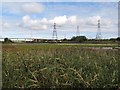
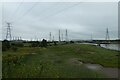
Living in CH5 2NH, a small residential cluster in Flintshire, Wales, means being part of a tightly knit community of 1,918 people spread across 35.2 hectares. This area, part of Connah’s Quay, sits on the River Dee estuary, a location that shaped its history as a key port in the 19th century. Today, it functions as a commuter hub with a mix of historical charm and modern practicality. The town’s maritime legacy is evident in its landmarks, such as the former Ferguson & Baird shipyard and the Old Quay House. Daily life here balances proximity to retail and transport with a quieter, residential atmosphere. With a population density of 570 people per square kilometre, the area feels compact yet functional, offering a blend of small-town character and access to nearby amenities. Its location near Shotton and the River Dee ensures a connection to both natural and industrial heritage, making it a unique spot for those seeking a mix of history and convenience.
- Area Type
- Postcode
- Area Size
- 35.2 hectares
- Population
- 1918
- Population Density
- 570 people/km²
The property market in CH5 2NH is characterised by a 40% home ownership rate, with houses being the primary accommodation type. This indicates a mix of owner-occupied homes and rental properties, though the small area size of 35.2 hectares suggests limited housing stock. The predominance of houses over flats or apartments may appeal to buyers seeking family-friendly homes with more space. However, the low home ownership rate also implies a significant portion of the market is rental-based, which could affect availability for buyers. Given the area’s compact nature, property seekers may need to look beyond CH5 2NH itself, particularly in nearby Shotton or Connah’s Quay, to find a broader range of options. The market likely reflects the town’s role as a commuter area, with properties catering to those working in larger centres like Chester or Liverpool.
House Prices in CH5 2NH
Showing 3 properties
| Address | Type | Beds | Baths | Last Sale Price | Last Sale Date | |
|---|---|---|---|---|---|---|
| Block 2 Shotton Point, Shotton Works, Weighbridge Road Westbound Carriageway A 548, Sealand, CH5 2NH | Office | - | - | - | - | |
| Block 1 Shotton Point, Shotton Works, Weighbridge Road Westbound Carriageway A 548, Sealand, CH5 2NH | Office | - | - | - | - | |
| Block 3 Shotton Point, Shotton Works, Weighbridge Road Westbound Carriageway A 548, Sealand, CH5 2NH | Office | - | - | - | - |
Energy Efficiency in CH5 2NH
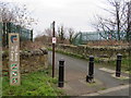
Residents of CH5 2NH have access to a range of amenities within walking or short driving distance. The retail sector includes five notable stores: Asda Quay, Tesco Connahs, and Lidl Connahs, providing everyday shopping needs. The area’s historical maritime heritage is complemented by modern leisure options, such as the Deeside Stadium, home to Connah’s Quay Town FC, and Coleg Cambria, a further education campus. The River Dee offers scenic views and a connection to the town’s past, while local pubs like the Old Quay House provide social spaces. The proximity to rail stations and Hawarden Airport enhances mobility, making it easier to access nearby towns or travel further afield. This blend of practical amenities and historical character contributes to a lifestyle that balances convenience with a sense of place.
Amenities
Schools
| Rank | School | Type | Entry gender | Ages |
|---|
Explore more schools in this area
Go to Schools tabDemographics
CH5 2NH has a median age of 47, with the majority of residents aged 30–64, reflecting a mature, established community. Home ownership stands at 40%, indicating a mix of owner-occupied properties and rental units. The accommodation type is predominantly houses, suggesting a focus on family homes rather than apartments. The predominant ethnic group is White, with no data provided on other demographics. The population density of 570 people per square kilometre implies a moderately populated area, though the small size of 35.2 hectares means residents are likely to know their neighbours. This demographic profile suggests a stable, long-term resident base, with fewer young families or transient populations compared to larger urban areas.
Household Size
Accommodation Type
Tenure
Ethnic Group
Religion
Household Composition
Age
Household Deprivation
NS-SEC
Explore more demographic insights in this area
Go to Demographics tabPlanning
Planning Constraints
- Flood RiskPremium
- Ramsar Wetland SitesPremium
- Area of Outstanding Natural BeautyPremium
- Protected Nature ReservePremium
- Protected WoodlandPremium
- Crime RiskPremium