Area Overview for CH5 2JT
Photos of CH5 2JT
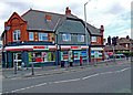
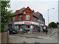
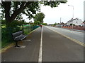
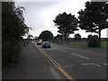
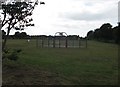
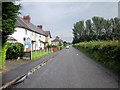
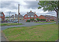
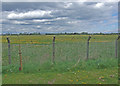
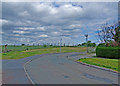
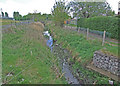
16 photos from this area
Area Information
Key information about the CH5 2JT including its size, population, and administrative classification.
- Area Type
- Postcode
- Area Size
- 1.6 hectares
- Population
- 1519
- Population Density
- 438 people/km²
House Prices in CH5 2JT
55
Properties
£73,955
Average Sold Price
£11,000
Lowest Price
£113,000
Highest Price
Showing 55 properties
| Address | Type | Beds | Baths | Last Sale Price | Last Sale Date | |
|---|---|---|---|---|---|---|
| 54 Riverside Park, Garden City, CH5 2JT | Semi-detached | 3 | 1 | £113,000 | Jun 2024 | |
| 44 Riverside Park, Garden City, CH5 2JT | house | 3 | 1 | £91,000 | Sep 2019 | |
| 50 Riverside Park, Garden City, CH5 2JT | Terraced | 4 | 2 | £82,500 | Jun 2015 | |
| 52 Riverside Park, Garden City, CH5 2JT | Semi-detached | 3 | - | £75,500 | Jul 2014 | |
| 43 Riverside Park, Garden City, CH5 2JT | house | - | - | £60,000 | Jan 2014 | |
| 82 Riverside Park, Garden City, CH5 2JT | Flat | - | - | £38,000 | Mar 2013 | |
| 47 Riverside Park, Garden City, CH5 2JT | Semi-detached | 3 | - | £85,000 | Dec 2012 | |
| 49 Riverside Park, Garden City, CH5 2JT | Terraced | - | - | £97,000 | Jan 2007 | |
| 48 Riverside Park, Garden City, CH5 2JT | house | - | - | £93,500 | Jun 2005 | |
| 67 Riverside Park, Garden City, CH5 2JT | Semi-detached | - | - | £67,000 | Aug 2003 |
Page 1 of 6
Energy Efficiency in CH5 2JT
Amenities
Schools
| Rank | School | Type | Entry gender | Ages |
|---|
Explore more schools in this area
Go to Schools tabDemographics
Household Size
Family (3-5 people)
most common
Accommodation Type
Houses
most common
Tenure
33
majority
Ethnic Group
White
most common
Religion
N/A
most common
Household Composition
N/A
most common
Age
47
median
Adults (30-64 years)
most common
Household Deprivation
N/A
with no deprivation
NS-SEC
13
in Lower managerial occupations
Explore more demographic insights in this area
Go to Demographics tabPlanning
Planning Constraints
- Flood RiskPremium
- Ramsar Wetland SitesPremium
- Area of Outstanding Natural BeautyPremium
- Protected Nature ReservePremium
- Protected WoodlandPremium
- Crime RiskPremium