Area Overview for CH5 1ZB
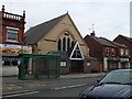
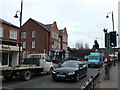
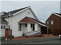
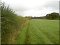
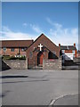
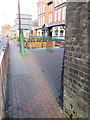
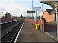
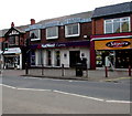
Photos of CH5 1ZB
Area Information
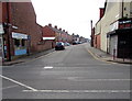
Living in CH5 1ZB, a small residential postcode in Flintshire, Wales, means being part of a community rooted in industrial history yet evolving into a modern, low-density area. With a population of 1,435, the area reflects a quiet, established character shaped by its proximity to the River Dee and its past as a steelworks hub. The landscape is defined by the remnants of the Shotton Steelworks, once a cornerstone of the local economy, now a symbol of the area’s transition from heavy industry to a more subdued residential focus. The postcode covers a cluster of homes, many of which date to the 20th century, offering a blend of traditional architecture and practical living spaces. Daily life here is influenced by its rural setting, with easy access to nearby towns like Connah’s Quay and the coastal amenities of North Wales. The area’s modest size means a tight-knit community feel, where local landmarks like the John Summers Clock Tower—once the steelworks’ headquarters—stand as reminders of its industrial past. For those seeking a balance between small-town charm and proximity to larger services, CH5 1ZB offers a distinct, if unassuming, slice of Welsh life.
- Area Type
- Postcode
- Area Size
- Not available
- Population
- 1435
- Population Density
- 3189 people/km²
The property market in CH5 1ZB is characterised by a 37% home ownership rate, with houses forming the predominant type of accommodation. This suggests a market where owner-occupation is not the norm, and rental properties may play a significant role in the housing stock. The presence of houses, rather than flats or apartments, indicates a preference for detached or semi-detached homes, which is typical of rural and semi-rural areas in Wales. For buyers considering the area, this means a limited selection of properties, as the postcode covers only a small cluster of homes. The low population density and historical industrial legacy may also influence property values, with homes potentially reflecting the area’s transition from industrial to residential use. Buyers should also consider the limited availability of newer developments, as the housing stock is largely rooted in the 20th century. The market is likely to appeal to those seeking a quiet, established community with a distinct character, though the small size of the area may limit options for those prioritising larger estates or modern housing.
House Prices in CH5 1ZB
No properties found in this postcode.
Energy Efficiency in CH5 1ZB
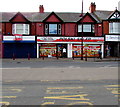
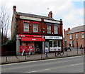
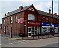
The lifestyle in CH5 1ZB is shaped by its proximity to retail, transport, and local facilities. Within practical reach, residents can access five retail outlets, including Asda Queensferry, Iceland Shotton, and Co-op Aston, providing essential shopping and grocery needs. The area’s rail network, with five nearby stations, ensures easy access to commuting routes, while Hawarden Airport offers a gateway for regional travel. Although the data does not specify parks or leisure facilities, the historical industrial character of the area may be complemented by open spaces or green belts in the surrounding region. The presence of the John Summers Clock Tower and the River Dee nearby suggests opportunities for walking or cycling, though specific recreational amenities are not detailed in the data. Overall, daily life in CH5 1ZB balances practicality with the quietude of a small community, where essential services are within reach but the area remains distinct from larger urban centres.
Amenities
Schools
Residents of CH5 1ZB have access to two schools within practical reach: Queens Ferry C.P. School and John Summers High School. Both institutions are listed as “other” in the data, though their specific educational focus or Ofsted ratings are not provided. The presence of both a primary and secondary school suggests a localised education system catering to families in the area. For parents, this proximity to schools could be a key consideration, as it reduces the need for long commutes. However, the absence of detailed performance data means prospective homebuyers may need to conduct further research into the quality of education available. The mix of school types—primary and secondary—implies a comprehensive educational offering for children living in CH5 1ZB, though the lack of specific metrics leaves room for uncertainty about academic standards or facilities.
| Rank | School | Type | Entry gender | Ages |
|---|
Explore more schools in this area
Go to Schools tabDemographics
The population of CH5 1ZB has a median age of 47, with the majority of residents falling within the 30–64 age range. This suggests a mature, stable community with a strong presence of middle-aged adults, likely tied to long-term residency or family life. Home ownership in the area stands at 37%, indicating a mix of owner-occupied and rental properties. The primary accommodation type is houses, which aligns with the area’s low-density, residential character. The predominant ethnic group is White, reflecting the demographic profile typical of rural Wales. While the data does not specify deprivation levels, the combination of a higher proportion of older residents and a relatively low home ownership rate may point to a community where older generations are more likely to own property, while younger residents may rely on rental housing. This dynamic could influence local services and amenities, with a focus on maintaining existing infrastructure rather than rapid expansion.
Household Size
Accommodation Type
Tenure
Ethnic Group
Religion
Household Composition
Age
Household Deprivation
NS-SEC
Explore more demographic insights in this area
Go to Demographics tabPlanning
Planning Constraints
- Flood RiskPremium
- Ramsar Wetland SitesPremium
- Area of Outstanding Natural BeautyPremium
- Protected Nature ReservePremium
- Protected WoodlandPremium
- Crime RiskPremium