Area Overview for CH5 1TJ
Photos of CH5 1TJ
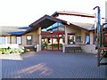
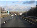
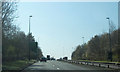
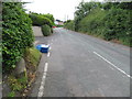
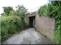

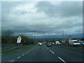
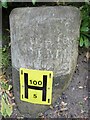
11 photos from this area
Area Information
Key information about the CH5 1TJ including its size, population, and administrative classification.
- Area Type
- Postcode
- Area Size
- 3.8 hectares
- Population
- 1435
- Population Density
- 3189 people/km²
House Prices in CH5 1TJ
46
Properties
£104,851
Average Sold Price
£14,625
Lowest Price
£220,000
Highest Price
Showing 46 properties
| Address | Type | Beds | Baths | Last Sale Price | Last Sale Date | |
|---|---|---|---|---|---|---|
| 46 Aston Road, Queensferry, CH5 1TJ | Semi-detached | 3 | 2 | £178,000 | Feb 2025 | |
| 4 Aston Road, Queensferry, CH5 1TJ | house | - | - | £129,950 | May 2023 | |
| 8 Aston Road, Queensferry, CH5 1TJ | Semi-detached | 3 | - | £135,000 | May 2021 | |
| Parkfield, Aston Road, Queensferry, CH5 1TJ | Semi-detached | 4 | - | £153,000 | Aug 2019 | |
| 16 Aston Road, Queensferry, CH5 1TJ | house | 3 | - | £95,000 | Aug 2018 | |
| 62 Aston Road, Queensferry, CH5 1TJ | house | - | - | £115,000 | Mar 2018 | |
| 30 Aston Road, Queensferry, CH5 1TJ | house | - | - | £120,000 | Jul 2017 | |
| Brookhurst, Aston Road, Queensferry, CH5 1TJ | Bungalow | - | - | £124,950 | Jul 2016 | |
| 60 Aston Road, Queensferry, CH5 1TJ | Terraced | 3 | 1 | £111,000 | Jan 2016 | |
| The Bungalow, Aston Road, Queensferry, CH5 1TJ | Bungalow | 2 | 1 | £78,000 | Sep 2013 |
Page 1 of 5
Energy Efficiency in CH5 1TJ
Amenities
Schools
| Rank | School | Type | Entry gender | Ages |
|---|
Explore more schools in this area
Go to Schools tabDemographics
Household Size
Family (3-5 people)
most common
Accommodation Type
Houses
most common
Tenure
37
majority
Ethnic Group
White
most common
Religion
N/A
most common
Household Composition
N/A
most common
Age
47
median
Adults (30-64 years)
most common
Household Deprivation
N/A
with no deprivation
NS-SEC
11
in Lower managerial occupations
Explore more demographic insights in this area
Go to Demographics tabPlanning
Planning Constraints
- Flood RiskPremium
- Ramsar Wetland SitesPremium
- Area of Outstanding Natural BeautyPremium
- Protected Nature ReservePremium
- Protected WoodlandPremium
- Crime RiskPremium