Area Overview for CH4 8QW
Photos of CH4 8QW
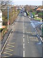
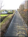
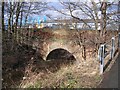
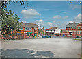
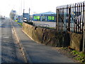
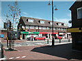
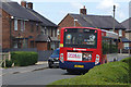
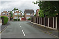
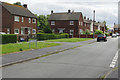
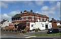
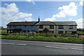
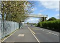
54 photos from this area
Area Information
Key information about the CH4 8QW including its size, population, and administrative classification.
- Area Type
- Postcode
- Area Size
- 8744 m²
- Population
- 1443
- Population Density
- 1720 people/km²
House Prices in CH4 8QW
29
Properties
£138,730
Average Sold Price
£53,500
Lowest Price
£249,950
Highest Price
Showing 29 properties
| Address | Type | Beds | Baths | Last Sale Price | Last Sale Date | |
|---|---|---|---|---|---|---|
| 26 Vyrnwy Road, Saltney, CH4 8QW | Detached | 3 | 1 | £180,000 | Jun 2021 | |
| 8 Vyrnwy Road, Saltney, CH4 8QW | house | - | - | £161,000 | Jul 2020 | |
| 28 Vyrnwy Road, Saltney, CH4 8QW | Detached | 3 | 1 | £180,000 | Nov 2019 | |
| 20 Vyrnwy Road, Saltney, CH4 8QW | Semi-detached | 3 | 2 | £168,000 | Jul 2018 | |
| 22 Vyrnwy Road, Saltney, CH4 8QW | house | 4 | 2 | £210,000 | Mar 2013 | |
| 44 Vyrnwy Road, Saltney, CH4 8QW | Semi-detached | 3 | 1 | £152,000 | Nov 2011 | |
| 58 Vyrnwy Road, Saltney, CH4 8QW | Semi-detached | - | - | £128,000 | Dec 2009 | |
| 46 Vyrnwy Road, Saltney, CH4 8QW | Semi-detached | - | - | £125,000 | May 2008 | |
| 12 Vyrnwy Road, Saltney, CH4 8QW | Detached | - | - | £249,950 | Oct 2007 | |
| 32 Vyrnwy Road, Saltney, CH4 8QW | Detached | - | - | £165,000 | May 2006 |
Page 1 of 3
Energy Efficiency in CH4 8QW
Amenities
Schools
| Rank | School | Type | Entry gender | Ages |
|---|
Explore more schools in this area
Go to Schools tabDemographics
Household Size
Two person
most common
Accommodation Type
Houses
most common
Tenure
82
majority
Ethnic Group
White
most common
Religion
N/A
most common
Household Composition
N/A
most common
Age
47
median
Adults (30-64 years)
most common
Household Deprivation
N/A
with no deprivation
NS-SEC
27
in Lower managerial occupations
Explore more demographic insights in this area
Go to Demographics tabPlanning
Planning Constraints
- Flood RiskPremium
- Ramsar Wetland SitesPremium
- Area of Outstanding Natural BeautyPremium
- Protected Nature ReservePremium
- Protected WoodlandPremium
- Crime RiskPremium