Area Overview for Broughton and Bretton Community
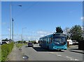
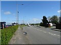
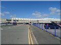
Photos of Broughton and Bretton Community

Area Information
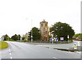
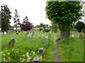
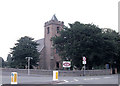
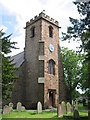
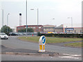
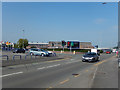
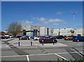
Living in Broughton and Bretton Community offers a settlement defined by its civil parish status and location on the Wales-England border. This area sits in Flintshire, Sir y Fflint, covering an area of 13.3 square kilometres. You will find the community situated approximately four miles south-east of Connah's Quay at coordinates 53.182828, -2.96269. The postcode CH4 0BA serves as the reference point for this township. Broughton forms the larger village within the parish, while Bretton operates as a smaller adjacent hamlet. Together these settlements comprise the ecclesiastical parish of Hawarden. The population stands at 2,717 residents, creating a specific density of 204 people per square kilometre. You live in a location with deep historical roots. First mentioned as 'Brochetune' in the Domesday Book of 1086, the area has a documented history spanning centuries. The terrain supports farming heritage from former Eaton and Gladstone estates, alongside a post-war shift towards light industry and commerce. Broughton Hall manor, owned by Glynne and Gladstone families until the 1970s, marks the former significance of the area. Today, the community functions as a rural township with access to local amenities and a transport network dating back to 1849. You are buying into a settled environment where village life meets regional connectivity. The settlement culture reflects its ecclesiastical ties and agricultural past. St Mary's Church anchors Broughton, commemorating the area's connection to the Johnson family heritage. The bretton Methodist chapel from 1859 provides further evidence of the community's established local institutions. Modern living here implies residence in a space where historic boundaries still influence the layout of Broughton and Bretton. The area maintains its character as a parish despite proximity to larger centres like Connah's Quay. Residents navigate a landscape marked by former railway bridges that now serve as footpaths, linking the past with current daily life.
- Area Type
- Parish
- Area Size
- 13.3 km²
- Population
- 2717
- Population Density
- 204 people/km²
Demographics
The population composition of Broughton and Bretton Community presents a distinct age profile. The median age for residents is 70 years old, indicating a community where older adults form a significant portion of the household population. This age distribution aligns with the broader total household composition data, which reflects the demographic weight of this demographic group. You will find that homes in this parish cater primarily to an older demographic rather than young families or single professionals seeking urban amenities. Home ownership stands at 76 per cent across the area. This high rate suggests that the majority of residents have secured their own homes within Broughton and Bretton. The remaining households rely on the rental sector or other forms of accommodation. The area includes a mix of accommodation types, from detached houses on former farmsteads to properties built to serve the local workforce. The churchwardens have recorded this stability for decades, noting the continuity of residents in the ecclesiastical parish of Hawarden. Diversity data for the predominant ethnic group and religious affiliation reflects the total population mix without specific breakdowns in the current dataset. However, the historical record shows a strong influence of the Glynne and Gladstone families, along with the Chester mayor William Johnson. The parish history reveals worship traditions established by the Bretton Methodist chapel in 1859 and St Mary's Church. These institutions continue to shape the social landscape. The community structure remains consistent with long-established rural parishes where ownership and long-term residence are key features. Living in Broughton and Bretton Community means joining an environment where generational stability plays a central role in the social fabric.
Household Size
Accommodation Type
Tenure
Ethnic Group
Religion
Household Composition
Age
Household Deprivation
NS-SEC
Explore more demographic insights in this area
Go to Demographics tabPlanning
Planning Constraints
- Flood RiskPremium
- Ramsar Wetland SitesPremium
- Area of Outstanding Natural BeautyPremium
- Protected Nature ReservePremium
- Protected WoodlandPremium
- Crime RiskPremium