Area Overview for Argoed Community
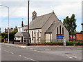
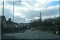
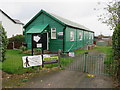
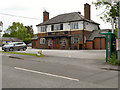
Photos of Argoed Community


Area Information
Argoed Community is a civil parish located in Flintshire, Wales, spanning a total area of 6.3 square kilometres. Situated strategically between the towns of Mold and Buckley, the community derives its name from the Welsh term for a wooded area, reflecting its historical roots within the ancient parish of Mold. The landscape is defined by specific settlements, with Mynydd Isa acting as the largest town alongside the smaller hamlets of New Brighton, Mynydd bychan, and Llong. Historically, the area dates back to around 1284 when it formed part of the ancient Mold parish under the Statute of Rhuddlan. Local governance evolved significantly over centuries, transitioning from Quarter Sessions to the establishment of the modern Argoed Community Council on 1 April 1985. This council was originally formed as the Mynydd Isa Community Council before renaming to reflect the historic township. Today, daily life here remains deeply connected to this heritage. Residents enjoy the benefits of a defined rural setting while maintaining proximity to larger settlement hubs. The community has undergone various local government reforms, including the 1974 Clwyd restructuring, which shaped its current administrative boundaries. Living in Argoed Community offers a distinctive character rooted in over a thousand years of history, underpinned by a strong sense of local identity preserved through centuries of administrative change.
- Area Type
- Parish
- Area Size
- 6.3 km²
- Population
- Not available
- Population Density
- Not available
Demographics
The community profile reveals a significantly older population compared to national averages, with a median age of 70 years. The demographic data indicates that age status is the primary factor influencing household composition across the parish. Home ownership is exceptionally high, standing at 88 per cent of all households. This suggests a community where residents have established long-term roots rather than transient tenures. While specific breakdowns regarding ethnicity and religion are not detailed in the current dataset, the high ownership rate points to a stable residential environment. The predominant ethnic group is recorded as total, which implies a lack of detailed segregation in the available statistics for this specific locality. Similarly, information regarding the predominant religious affiliation is not broken down. This high level of home ownership often correlates with an older demographic settling into a retirement-oriented lifestyle. The absence of young families or a mixed-age transient population is evident from the 70-year median age. This demographic reality shapes the local services and social fabric, creating an environment where residents known to the area and deeply connected to the land around Mynydd Isa and the surrounding hamlets.
Household Size
Accommodation Type
Tenure
Ethnic Group
Religion
Household Composition
Age
Household Deprivation
NS-SEC
Explore more demographic insights in this area
Go to Demographics tabPlanning
Planning Constraints
- Flood RiskPremium
- Ramsar Wetland SitesPremium
- Area of Outstanding Natural BeautyPremium
- Protected Nature ReservePremium
- Protected WoodlandPremium
- Crime RiskPremium