Area Overview for LL15 2DD
Photos of LL15 2DD
Area Information
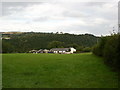
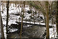
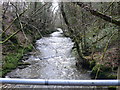
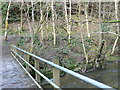
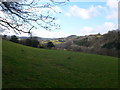
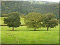
Living in LL15 2DD means being part of a small, tightly knit residential cluster in north Wales. The area spans 37.2 hectares and is home to 1,798 people, with a population density of just 17 people per square kilometre. This low density suggests a quiet, rural feel, typical of smaller Welsh communities. The area’s character is defined by its modest scale and proximity to natural landscapes, though specific details about local geography are sparse. Residents here are predominantly adults aged 30–64, with a median age of 47, indicating a mature, stable community. The housing stock is largely owner-occupied, with 77% of homes owned by residents, and the majority are houses rather than flats. This suggests a focus on family living and long-term residency. While the area lacks major urban amenities, its small size and low population mean a sense of privacy and slower pace. For those prioritising space over convenience, LL15 2DD offers a distinct alternative to denser urban environments.
- Area Type
- Postcode
- Area Size
- 37.2 hectares
- Population
- 1798
- Population Density
- 17 people/km²
The property market in LL15 2DD is characterised by a high rate of home ownership—77% of homes are owner-occupied—suggesting a community of long-term residents rather than a rental-heavy market. The accommodation type is predominantly houses, which is typical for smaller, rural areas where land availability allows for larger properties. This focus on houses implies that the area is more suited to families or individuals seeking space rather than investors looking for high-yield rental opportunities. Given the area’s small size and limited data on property prices, the market is likely niche, with fewer options for buyers. Those considering LL15 2DD should note that the housing stock is unlikely to change significantly, as the area’s low population density and existing infrastructure suggest a static, rather than expanding, property market.
House Prices in LL15 2DD
Showing 8 properties
| Address | Type | Beds | Baths | Last Sale Price | Last Sale Date | |
|---|---|---|---|---|---|---|
| Tan Yr Hengoed, Hengoed Junction To Bryn Caredig Road, Bontuchel, Ruthin, LL15 2DD | house | - | - | £625,000 | Jun 2008 | |
| Pantmawr, Penyrhengoed Junction To Bontuchel, Bontuchel, Ruthin, LL15 2DD | Detached | 4 | 2 | - | - | |
| Caravan At, Tan Yr Hengoed, Hengoed Junction To Bryn Caredig Road, Bontuchel, Ruthin, LL15 2DD | Mobile Home | - | - | - | - | |
| Coed Yr Hengoed, Hengoed Junction To Bryn Caredig Road, Bontuchel, Ruthin, LL15 2DD | Mobile Home | - | - | - | - | |
| Hengoed Isa, Penyrhengoed Junction To Bontuchel, Bontuchel, Ruthin, LL15 2DD | house | - | - | - | - | |
| Craigle, Penyrhengoed Junction To Bontuchel, Bontuchel, Ruthin, LL15 2DD | Bungalow | - | - | - | - | |
| Hengoed, Hengoed Junction To Bryn Caredig Road, Bontuchel, Ruthin, LL15 2DD | Detached | - | - | - | - | |
| Caravan, Coed Yr Hengoed, Hengoed Junction To Bryn Caredig Road, Bontuchel, Ruthin, LL15 2DD | Mobile Home | - | - | - | - |
Energy Efficiency in LL15 2DD
The lifestyle in LL15 2DD is shaped by its small size and proximity to essential retail services. Within practical reach are five retail outlets, including Aldi Ruthin, Morrisons Daily, and Co-op Ruthin. These stores provide access to groceries, household goods, and everyday necessities, reducing the need for long trips to larger towns. The area’s low population density means fewer dining or leisure options are explicitly listed, but the presence of these shops suggests a basic level of convenience. The rural setting may offer access to natural spaces, though no specific parks or recreational facilities are named in the data. For residents prioritising practicality over luxury, the nearby retail amenities provide a functional, if limited, lifestyle.
Amenities
Schools
Residents of LL15 2DD have access to three schools: Ysgol Cyffylliog, Ysgol Bro Cinmeirch, and Ysgol Pant Pastynog. All are categorised as “other” in the data, though no specific Ofsted ratings or academic performance metrics are provided. The presence of three schools suggests a basic educational infrastructure, but without further details on their types—such as primary, secondary, or specialist institutions—it is unclear whether they cater to all stages of education. Families requiring a range of school options may need to look beyond the immediate area, as the data does not indicate a mix of school types. The lack of performance data means it is difficult to assess the quality of education available, though the availability of multiple schools is a practical advantage for local families.
| Rank | School | Type | Entry gender | Ages |
|---|
Explore more schools in this area
Go to Schools tabDemographics
The community in LL15 2DD is predominantly composed of adults aged 30–64, with a median age of 47. This age range reflects a mature population, likely with established careers and families. Home ownership is high, at 77%, indicating a strong presence of long-term residents rather than renters. The accommodation type is primarily houses, which aligns with the area’s low population density and suggests a focus on single-family homes. The predominant ethnic group is White, though no further breakdown of diversity is provided. The absence of specific data on deprivation or socioeconomic status means it is unclear how this affects daily life, but the high home ownership rate and age profile suggest a relatively stable, middle-income demographic. The area’s small size and limited data mean it is not a place for those seeking a highly diverse or rapidly changing community.
Household Size
Accommodation Type
Tenure
Ethnic Group
Religion
Household Composition
Age
Household Deprivation
NS-SEC
Explore more demographic insights in this area
Go to Demographics tabPlanning
Planning Constraints
- Flood RiskPremium
- Ramsar Wetland SitesPremium
- Area of Outstanding Natural BeautyPremium
- Protected Nature ReservePremium
- Protected WoodlandPremium
- Crime RiskPremium