Area Overview for LL15 2BS
Photos of LL15 2BS
Area Information
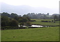
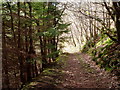
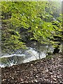
LL15 2BS is a small residential cluster in north Wales, covering 98.2 hectares and home to 2,239 people. The area’s low population density of 49 people per square kilometre suggests a quiet, spread-out community. It sits in a rural setting, with no major urban infrastructure nearby, making it ideal for those seeking a slower pace of life. The area’s character is defined by its modest scale — it is not a town or city but a tightly knit postcode cluster. Daily life here likely revolves around local amenities, with residents relying on nearby villages for broader services. The absence of protected natural sites like AONBs or Ramsar wetlands means development constraints are minimal, though a small portion of the area falls under protected woodland. This balance of low environmental risk and limited planning restrictions makes LL15 2BS a pragmatic choice for buyers seeking affordability and simplicity.
- Area Type
- Postcode
- Area Size
- 98.2 hectares
- Population
- 2239
- Population Density
- 49 people/km²
LL15 2BS is primarily an owner-occupied area, with 73% of homes owned by their residents. The accommodation type is exclusively houses, which is unusual for a small postcode area but aligns with the low population density. This suggests a mix of detached and semi-detached properties, typical of rural Wales. The small size of the area means the housing stock is limited, and buyers may need to look beyond the immediate postcode for more options. The high home ownership rate indicates a stable market, with little pressure from rental demand. For buyers, this could mean fewer competing offers but also limited scope for investment in new builds. The focus on houses rather than flats or apartments reflects the area’s traditional housing patterns.
House Prices in LL15 2BS
Showing 5 properties
| Address | Type | Beds | Baths | Last Sale Price | Last Sale Date | |
|---|---|---|---|---|---|---|
| Maes Annod, Track To Maesannod Farm, Bontuchel, Ruthin, LL15 2BS | Detached | - | - | - | - | |
| Pant Glas Isaf, Loop Inc Pont Glaf Isa And Pant Glas Canol, Bontuchel, Ruthin, LL15 2BS | Detached | - | - | - | - | |
| Tan Y Bryn, Loop Inc Pont Glaf Isa And Pant Glas Canol, Bontuchel, Ruthin, LL15 2BS | Detached | - | - | - | - | |
| Pantglas Ganol, Loop Inc Pont Glaf Isa And Pant Glas Canol, Bontuchel, Ruthin, LL15 2BS | Semi-detached | - | - | - | - | |
| Bryn Glas, Loop Inc Pont Glaf Isa And Pant Glas Canol, Bontuchel, Ruthin, LL15 2BS | Semi-detached | 2 | 2 | - | - |
Energy Efficiency in LL15 2BS
Residents of LL15 2BS have access to five retail amenities within practical reach, including Aldi Ruthin, Morrisons Daily, and Tesco Ruthin. These stores provide essential shopping options, though the selection is limited compared to larger towns. The area lacks named parks, restaurants, or leisure facilities in the data, suggesting that entertainment and dining options are concentrated in nearby villages. The absence of specific venues means daily life may revolve around local shops and community spaces. The proximity to retail hubs indicates convenience for basic needs, but those seeking a vibrant social scene may need to travel further. The lifestyle here is practical, with amenities focused on utility rather than variety.
Amenities
Schools
The nearest schools to LL15 2BS are Ysgol Bryn Clwyd and Rhewl C.P. School, both categorised as "other" in the data. No Ofsted ratings or specific educational outcomes are provided, so it is unclear how these institutions compare to national standards. The presence of two schools suggests some local provision for primary and secondary education, though families may need to travel to larger towns for broader options. The mix of school types is not detailed, but the lack of specialist or private schools implies a reliance on state education. For families prioritising proximity to schools, this area offers basic coverage but may require additional research into quality and facilities.
| Rank | School | Type | Entry gender | Ages |
|---|
Explore more schools in this area
Go to Schools tabDemographics
The population of LL15 2BS has a median age of 47, with the largest age group being adults aged 30–64. This suggests a community of middle-aged residents, likely focused on stability and long-term living. Home ownership is high at 73%, indicating a strong presence of owner-occupied properties. The accommodation type is predominantly houses, which aligns with the area’s low density and rural character. The predominant ethnic group is White, though no further breakdown of diversity is provided. The age profile and ownership rates imply a mature, settled population with fewer young families or transient renters. This demographic structure may influence local services, with amenities tailored to adult needs rather than children’s facilities.
Household Size
Accommodation Type
Tenure
Ethnic Group
Religion
Household Composition
Age
Household Deprivation
NS-SEC
Explore more demographic insights in this area
Go to Demographics tabPlanning
Planning Constraints
- Flood RiskPremium
- Ramsar Wetland SitesPremium
- Area of Outstanding Natural BeautyPremium
- Protected Nature ReservePremium
- Protected WoodlandPremium
- Crime RiskPremium