Area Overview for SA48 8AX
Photos of SA48 8AX


Area Information
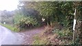
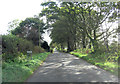
Living in SA48 8AX means residing in a very small residential cluster in Wales, defined by a specific postcode covering only 1.2 square kilometres. This compact footprint resulted in a low population count of 1,390 residents in the most recent census. The area's size ensures a quiet environment with minimal traffic pressure, as the settlement is restricted to a few roads and properties. You will find that daily life revolves around this immediate localised community rather than distant city centres. The physical scale of 1.2 km² dictates that most daily needs are potentially walkable or require very short car journeys. People here value the intimate nature of the neighbourhood where everyone knows everyone else, a direct result of the high density relative to the land area. Although the population is small, the area provides a complete living environment without the noise and congestion of larger towns. The sense of place is defined by its exclusivity as a defined postcode zone rather than a sprawling district. This concentration creates a strong sense of locality for any homebuyer looking for a secluded yet accessible spot in South West Wales. Upon arrival, the landscape speaks directly to a slower pace of life suited to those who prefer privacy over urban anonymity.
- Area Type
- Postcode
- Area Size
- 1.2 km²
- Population
- 1390
- Population Density
- 19 people/km²
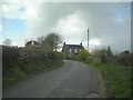
The property market in SA48 8AX reflects a quiet, owner-occupied sector with no new developments or rental schemes dominating the landscape. Homes in SA48 8AX are almost entirely houses, meaning you will not find flats or converted appertments available for purchase within this specific postcode. This focus on standalone dwellings attracts buyers who prioritise space and ground levels over urban density. With 82% of properties occupied by owners, the market is characterised by stability rather than turnover. This high ownership rate means that investment properties or short-term lettings form a negligible part of the housing stock. For buyers searching for homes in this area, the primary option is to purchase an existing property from someone who has already established their roots in the locality. The lack of rental listings suggests a limited pool of tenants, which benefits owners but might slow the search for first-time buyers looking to enter the market without a deposit. The housing stock does not show signs of regeneration, as no new builds are recorded or planned within the small cluster. Consequently, properties here maintain the character and architectural style of the original construction, offering a stable appreciation pattern linked to owner-occupation in rural Wales. When viewing homes near SA48 8AX, expect to see traditional Welsh architecture designed for the local climate and family life.
House Prices in SA48 8AX
Showing 12 properties
Energy Efficiency in SA48 8AX
Living in SA48 8AX offers a quiet lifestyle with access to essential retail services in Lampeter, a nearby market town within practical driving distance. Within your reach are two main supermarkets, Sainsburys Lampeter and Co-op Lampeter, ensuring you never run out of groceries. These venues provide all the major shopping needs for families living in the small residential cluster without requiring a trip to a larger city centre. Daily errands for essentials like fresh produce, household goods, and daily items are conveniently managed through these two stores located in the town centre. Beyond general shopping, there are no specific leisure centres, parks, or cinemas listed as immediate amenities directly adjacent to the postcode. Your local leisure activities will largely depend on what is available in Lampeter or further afield, meaning you may find a need for a car to reach festivals or specialised events. The simplicity of the area means that weekends are often spent enjoying the peace of the surroundings or visiting the local shops for coffee and snacks. The retail presence is functional rather than social, catering to practical needs rather than entertainment. This setup provides a tranquil backdrop for your home life while maintaining a link to community life in Lampeter for weekend programmes or essential shopping trips.
Amenities
Schools
Schools near SA48 8AX are limited in number due to the remote location, but the nearest option serves the entire community. Ysgol Y Dderi is the closest facility to your home in this postcode area. The school type is listed as 'other', which indicates a non-mainstream provision for local needs, such as special educational requirements or alternative learning environments. This classification means the immediate district does not contain a standard primary or secondary academy for general attendance. Families living in SA48 8AX must rely on this single institution or potentially travel further to the nearest larger county town for comprehensive secondary education. The absence of multiple schools in the immediate vicinity reinforces the rural nature of the settlement and the reliance on private transport for educational commutes. You should verify the specific curriculum and age range of Ysgol Y Dderi based on your child's needs, as general school types may vary in rural Wales. The presence of this single, distinct school highlights the compact catchment area of the postcode and the importance of travel time for education. Residents should plan for longer commutes if they require broader subject offerings not available at this specific location.
| Rank | School | Type | Entry gender | Ages |
|---|
Explore more schools in this area
Go to Schools tabDemographics
The community within SA48 8AX is distinguished by a mature and established population profile. The median age stands at 47 years, reflecting a settlement that has seen significant resettlement by adults in their working and retirement years. The most common age range for residents is adults aged between 30 and 64 years, indicating the area is filled with established families and older professionals. These demographics create a quiet atmosphere with very little transient activity compared to commuter hubs or student strongholds. Home ownership accounts for a substantial 82% of properties, showing a highly stable community where long-term residents are the norm. This high rate of ownership suggests that most people in SA48 8AX have remained in their homes for many years, contributing to the social fabric of the neighbourhood. Children and young adults under 30 are less prevalent, aligning with the older median age and the dominance of family households with older parents. The accommodation stock consists exclusively of houses, reinforcing the appeal for those seeking detached or semi-detached living rather than apartments. The predominant ethnic group is White, mirroring the broader demographic trends of rural Wales. You will find a cohesive community where neighbours have likely known one another for decades, creating a safe and familiar environment for families with children.
Household Size
Accommodation Type
Tenure
Ethnic Group
Religion
Household Composition
Age
Household Deprivation
NS-SEC
Explore more demographic insights in this area
Go to Demographics tabPlanning
Planning Constraints
- Flood RiskPremium
- Ramsar Wetland SitesPremium
- Area of Outstanding Natural BeautyPremium
- Protected Nature ReservePremium
- Protected WoodlandPremium
- Crime RiskPremium