Area Overview for SA48 8AJ
Photos of SA48 8AJ
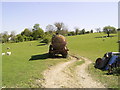

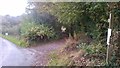
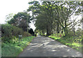
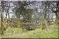
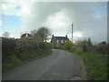
7 photos from this area
Area Information
Key information about the SA48 8AJ including its size, population, and administrative classification.
- Area Type
- Postcode
- Area Size
- 12.8 hectares
- Population
- 1390
- Population Density
- 19 people/km²
House Prices in SA48 8AJ
15
Properties
£142,034
Average Sold Price
£57,000
Lowest Price
£217,000
Highest Price
Showing 15 properties
| Address | Type | Beds | Baths | Last Sale Price | Last Sale Date | |
|---|---|---|---|---|---|---|
| 7 Clos Tawela, Silian, SA48 8AJ | Detached | 3 | 1 | £195,000 | Mar 2024 | |
| 10 Clos Tawela, Silian, SA48 8AJ | Bungalow | 3 | 1 | £217,000 | May 2023 | |
| 1 Clos Tawela, Silian, SA48 8AJ | Detached | - | - | £150,000 | Feb 2023 | |
| 13 Clos Tawela, Silian, SA48 8AJ | Retail | 2 | 1 | £200,000 | Jul 2022 | |
| 3 Clos Tawela, Silian, SA48 8AJ | Bungalow | 3 | 1 | £145,000 | Jan 2019 | |
| Llety Gwyn, 11 Clos Tawela, Silian, SA48 8AJ | Bungalow | 3 | 1 | £164,000 | Aug 2018 | |
| Ty Helyg, 5 Clos Tawela, Silian, SA48 8AJ | Bungalow | 3 | - | £139,500 | Aug 2017 | |
| 8 Clos Tawela, Silian, SA48 8AJ | Detached | 2 | 1 | £99,946 | Sep 2016 | |
| 9 Clos Tawela, Silian, SA48 8AJ | house | 3 | - | £145,000 | Jul 2014 | |
| 2 Clos Tawela, Silian, SA48 8AJ | Bungalow | 3 | 1 | £121,000 | Oct 2011 |
Page 1 of 2
Energy Efficiency in SA48 8AJ
Amenities
Schools
| Rank | School | Type | Entry gender | Ages |
|---|
Explore more schools in this area
Go to Schools tabDemographics
Household Size
Two person
most common
Accommodation Type
Houses
most common
Tenure
82
majority
Ethnic Group
White
most common
Religion
N/A
most common
Household Composition
N/A
most common
Age
47
median
Adults (30-64 years)
most common
Household Deprivation
N/A
with no deprivation
NS-SEC
33
in Lower managerial occupations
Explore more demographic insights in this area
Go to Demographics tabPlanning
Planning Constraints
- Flood RiskPremium
- Ramsar Wetland SitesPremium
- Area of Outstanding Natural BeautyPremium
- Protected Nature ReservePremium
- Protected WoodlandPremium
- Crime RiskPremium