Area Overview for SA48 8AD
Photos of SA48 8AD
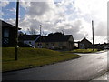
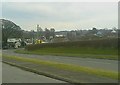
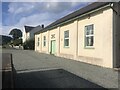
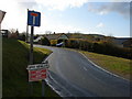
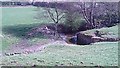
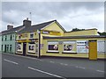
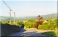
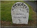
17 photos from this area
Area Information
Key information about the SA48 8AD including its size, population, and administrative classification.
- Area Type
- Postcode
- Area Size
- 21.6 hectares
- Population
- 2036
- Population Density
- 28 people/km²
House Prices in SA48 8AD
55
Properties
£123,875
Average Sold Price
£12,200
Lowest Price
£217,500
Highest Price
Showing 55 properties
| Address | Type | Beds | Baths | Last Sale Price | Last Sale Date | |
|---|---|---|---|---|---|---|
| 6 Bro Henllys, Felinfach, SA48 8AD | Semi-detached | 3 | 1 | £165,000 | Nov 2024 | |
| 19 Bro Henllys, Felinfach, SA48 8AD | Semi-detached | 3 | 1 | £185,500 | Nov 2023 | |
| 13 Bro Henllys, Felinfach, SA48 8AD | Semi-detached | 3 | 2 | £215,000 | Aug 2023 | |
| Erw'r Delyn, 28 Bro Henllys, Felinfach, SA48 8AD | Semi-detached | 3 | - | £217,500 | Mar 2023 | |
| 48 Bro Henllys, Felinfach, SA48 8AD | house | - | - | £139,550 | Nov 2022 | |
| 46 Bro Henllys, Felinfach, SA48 8AD | house | - | - | £127,000 | Jul 2022 | |
| 14 Bro Henllys, Felinfach, SA48 8AD | Semi-detached | 3 | 1 | £195,000 | Jun 2022 | |
| 15 Bro Henllys, Felinfach, SA48 8AD | Semi-detached | 3 | - | £90,000 | Feb 2019 | |
| 3 Bro Henllys, Felinfach, SA48 8AD | house | - | - | £120,000 | Oct 2018 | |
| 10 Bro Henllys, Felinfach, SA48 8AD | Semi-detached | 3 | - | £100,000 | Oct 2018 |
Page 1 of 6
Energy Efficiency in SA48 8AD
Amenities
Schools
| Rank | School | Type | Entry gender | Ages |
|---|
Explore more schools in this area
Go to Schools tabDemographics
Household Size
Two person
most common
Accommodation Type
Houses
most common
Tenure
75
majority
Ethnic Group
White
most common
Religion
N/A
most common
Household Composition
N/A
most common
Age
47
median
Adults (30-64 years)
most common
Household Deprivation
N/A
with no deprivation
NS-SEC
27
in Lower managerial occupations
Explore more demographic insights in this area
Go to Demographics tabPlanning
Planning Constraints
- Flood RiskPremium
- Ramsar Wetland SitesPremium
- Area of Outstanding Natural BeautyPremium
- Protected Nature ReservePremium
- Protected WoodlandPremium
- Crime RiskPremium