Area Overview for SA48 8BQ
Photos of SA48 8BQ
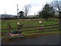
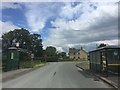
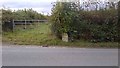
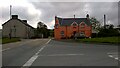
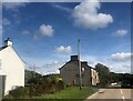
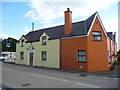
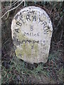
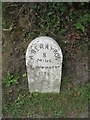
8 photos from this area
Area Information
Key information about the SA48 8BQ including its size, population, and administrative classification.
- Area Type
- Postcode
- Area Size
- 29.8 hectares
- Population
- 2036
- Population Density
- 28 people/km²
House Prices in SA48 8BQ
22
Properties
£179,900
Average Sold Price
£50,500
Lowest Price
£395,000
Highest Price
Showing 22 properties
| Address | Type | Beds | Baths | Last Sale Price | Last Sale Date | |
|---|---|---|---|---|---|---|
| Cwmclyd, B 4337 From Temple Bar To Private Road Leading To Cae Gwyn, Temple Bar, Felinfach, SA48 8BQ | Bungalow | 3 | - | £395,000 | Mar 2021 | |
| Trewilym, B 4337 Temple Bar, Temple Bar, Felinfach, SA48 8BQ | Detached | 3 | 2 | £147,500 | Aug 2019 | |
| Nantydderwen, B 4337 Temple Bar, Temple Bar, Felinfach, SA48 8BQ | Detached | 7 | 5 | £225,000 | Dec 2017 | |
| Clydfan, B 4337 Temple Bar, Temple Bar, Felinfach, SA48 8BQ | Bungalow | 2 | - | £81,500 | Oct 2016 | |
| Llwynferlig, B 4337 Temple Bar, Temple Bar, Felinfach, SA48 8BQ | Detached | - | - | £50,500 | Jan 1997 | |
| Oaklea, B 4337 Temple Bar, Temple Bar, Felinfach, SA48 8BQ | Detached | 7 | 5 | - | - | |
| Ground Floor Flat, Brynmair, B 4337 Temple Bar, Temple Bar, Felinfach, SA48 8BQ | Flat | 6 | - | - | - | |
| Tir Awela, B 4337 Temple Bar, Temple Bar, Felinfach, SA48 8BQ | Detached | - | - | - | - | |
| Arfryn, B 4337 Temple Bar, Temple Bar, Felinfach, SA48 8BQ | Detached | - | - | - | - | |
| Fronfelin Arms, A 482 Temple Bar, Temple Bar, Felinfach, SA48 8BQ | Flat | - | - | - | - |
Page 1 of 3
Energy Efficiency in SA48 8BQ
Amenities
Schools
| Rank | School | Type | Entry gender | Ages |
|---|
Explore more schools in this area
Go to Schools tabDemographics
Household Size
Two person
most common
Accommodation Type
Houses
most common
Tenure
75
majority
Ethnic Group
White
most common
Religion
N/A
most common
Household Composition
N/A
most common
Age
47
median
Adults (30-64 years)
most common
Household Deprivation
N/A
with no deprivation
NS-SEC
27
in Lower managerial occupations
Explore more demographic insights in this area
Go to Demographics tabPlanning
Planning Constraints
- Flood RiskPremium
- Ramsar Wetland SitesPremium
- Area of Outstanding Natural BeautyPremium
- Protected Nature ReservePremium
- Protected WoodlandPremium
- Crime RiskPremium