Area Overview for SA43 2HQ
Photos of SA43 2HQ
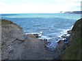
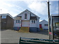
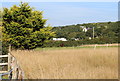
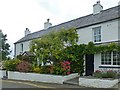
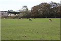
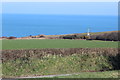
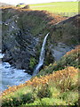
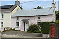
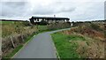
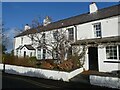
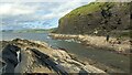
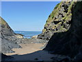
34 photos from this area
Area Information
Key information about the SA43 2HQ including its size, population, and administrative classification.
- Area Type
- Postcode
- Area Size
- 5994 m²
- Population
- 1043
- Population Density
- 295 people/km²
House Prices in SA43 2HQ
10
Properties
£163,333
Average Sold Price
£135,000
Lowest Price
£228,000
Highest Price
Showing 10 properties
| Address | Type | Beds | Baths | Last Sale Price | Last Sale Date | |
|---|---|---|---|---|---|---|
| Marazion, 3 Heol Y Gorwel, Aberporth, SA43 2HQ | Cottage | 3 | 1 | £228,000 | Apr 2024 | |
| 4 Heol Y Gorwel, Aberporth, SA43 2HQ | Bungalow | 3 | 1 | £159,000 | Dec 2017 | |
| West Ways, 8 Heol Y Gorwel, Aberporth, SA43 2HQ | Bungalow | 2 | - | £152,000 | Aug 2013 | |
| ANCHORAGE, 7 HEOL Y GORWEL, Aberporth, SA43 2HQ | Bungalow | - | - | £170,000 | Aug 2012 | |
| 9 Heol Y Gorwel, Aberporth, SA43 2HQ | Bungalow | - | - | £135,000 | May 2012 | |
| Y-wenallt, 5 Heol Y Gorwel, Aberporth, SA43 2HQ | Bungalow | - | - | £136,000 | Mar 2007 | |
| Wistaria, 1 Heol Y Gorwel, Aberporth, SA43 2HQ | Semi-detached | 2 | 1 | - | - | |
| Y Gragen, 6 Heol Y Gorwel, Aberporth, SA43 2HQ | Semi-detached | 2 | 1 | - | - | |
| Niwl Y Mor, 2 Heol Y Gorwel, Aberporth, SA43 2HQ | Bungalow | - | - | - | - | |
| Private Workshop, Y-wenallt, 5 Heol Y Gorwel, Aberporth, SA43 2HQ | Detached | - | - | - | - |
Energy Efficiency in SA43 2HQ
Amenities
Schools
| Rank | School | Type | Entry gender | Ages |
|---|
Explore more schools in this area
Go to Schools tabDemographics
Household Size
Two person
most common
Accommodation Type
Houses
most common
Tenure
60
majority
Ethnic Group
White
most common
Religion
N/A
most common
Household Composition
N/A
most common
Age
47
median
Adults (30-64 years)
most common
Household Deprivation
N/A
with no deprivation
NS-SEC
28
in Lower managerial occupations
Explore more demographic insights in this area
Go to Demographics tabPlanning
Planning Constraints
- Flood RiskPremium
- Ramsar Wetland SitesPremium
- Area of Outstanding Natural BeautyPremium
- Protected Nature ReservePremium
- Protected WoodlandPremium
- Crime RiskPremium