Area Overview for SA43 2HE
Photos of SA43 2HE

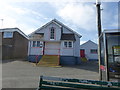
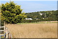


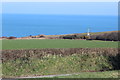
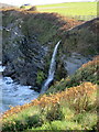
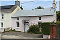

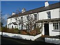


34 photos from this area
Area Information
Key information about the SA43 2HE including its size, population, and administrative classification.
- Area Type
- Postcode
- Area Size
- 8235 m²
- Population
- 1043
- Population Density
- 295 people/km²
House Prices in SA43 2HE
15
Properties
£147,828
Average Sold Price
£70,000
Lowest Price
£218,000
Highest Price
Showing 15 properties
| Address | Type | Beds | Baths | Last Sale Price | Last Sale Date | |
|---|---|---|---|---|---|---|
| Porthill, 1 Heol Yr Wylan, Aberporth, SA43 2HE | Bungalow | 2 | 1 | £218,000 | May 2025 | |
| 2 Heol Y Wylan, Aberporth, Cardigan, SA43 2HE | Bungalow | 4 | 2 | £155,000 | Jan 2020 | |
| Jampot Cottage, 7 Heol Yr Wylan, Aberporth, SA43 2HE | Bungalow | - | - | £209,000 | Dec 2019 | |
| Poseidon, 4 Heol Yr Wylan, Aberporth, SA43 2HE | Terraced | - | - | £135,000 | May 2019 | |
| 8 Heol Yr Wylan, Aberporth, SA43 2HE | Semi-detached | 2 | 1 | £156,000 | Aug 2018 | |
| Caegarw, 6 Heol Yr Wylan, Aberporth, SA43 2HE | Bungalow | 2 | 1 | £119,995 | Nov 2015 | |
| Plas Y Don, Heol Yr Wylan, Aberporth, SA43 2HE | house | - | - | £124,000 | Sep 2014 | |
| Glyncoed, 3 Heol Yr Wylan, Aberporth, SA43 2HE | Terraced | - | - | £139,950 | Jun 2014 | |
| 9 Heol Yr Wylan, Aberporth, SA43 2HE | Bungalow | 2 | 1 | £142,000 | May 2007 | |
| Norton, 12 Heol Yr Wylan, Aberporth, SA43 2HE | Bungalow | 3 | 1 | £149,995 | Dec 2004 |
Page 1 of 2
Energy Efficiency in SA43 2HE
Amenities
Schools
| Rank | School | Type | Entry gender | Ages |
|---|
Explore more schools in this area
Go to Schools tabDemographics
Household Size
Two person
most common
Accommodation Type
Houses
most common
Tenure
60
majority
Ethnic Group
White
most common
Religion
N/A
most common
Household Composition
N/A
most common
Age
47
median
Adults (30-64 years)
most common
Household Deprivation
N/A
with no deprivation
NS-SEC
28
in Lower managerial occupations
Explore more demographic insights in this area
Go to Demographics tabPlanning
Planning Constraints
- Flood RiskPremium
- Ramsar Wetland SitesPremium
- Area of Outstanding Natural BeautyPremium
- Protected Nature ReservePremium
- Protected WoodlandPremium
- Crime RiskPremium