Area Overview for SA32 7PE
Photos of SA32 7PE
Area Information
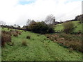
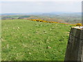
Living in SA32 7PE means residing within a very compact residential cluster situated in Wales. This specific postcode covers an area of only 14.6 hectares containing a population of just over 1,000 people. Consequently, the population density is low, standing at 9 people per square kilometre. Residents experience a quiet environment defined by small-scale housing rather than large-scale development. The area functions as a peaceful pocket of community life where daily routines are shaped by close proximity to neighbours. You are part of a small demographic where the built environment does not overwhelm the natural surroundings. This locality offers a distinct sense of space that larger towns cannot match. Daily life here revolves around a defined, manageable footprint where you know the boundaries of your immediate neighbourhood. The limited size ensures that the area remains intimate and unwelcoming to massive commercial intrusion. It is a place where the scale of your immediate world is always clear and predictable. You live in an environment that prioritises tranquility over urban convenience.
- Area Type
- Postcode
- Area Size
- 14.6 hectares
- Population
- 1048
- Population Density
- 9 people/km²
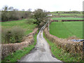
The property market in SA32 7PE is defined by a heavy concentration of owner-occupied homes. With 84 per cent of households owning their properties, the area functions primarily as an established residential market rather than a rental hotspot. This high ownership figure signals that the local housing stock consists of families who have invested in building equity over time. The accommodation type is exclusively houses, meaning you will not find blocks of flats or purpose-built rental accommodations within this specific cluster. Potential buyers looking at homes in SA32 7PE should expect to find detached or semi-detached properties typical of Welsh rural settings. The market reflects stability and low turnover, as owners are less likely to move frequently compared to renters. This environment suits buyers seeking a forever home rather than a temporary stopover. You are looking at properties where the original occupants have likely stayed for decades. The lack of rental inventory simplifies the search process for those wishing to settle permanently.
House Prices in SA32 7PE
Showing 2 properties
| Address | Type | Beds | Baths | Last Sale Price | Last Sale Date | |
|---|---|---|---|---|---|---|
| Colomendy, Graig Road, Nantgaredig, Carmarthen, SA32 7PE | Detached | - | - | - | - | |
| Penlan, Graig Road, Nantgaredig, Carmarthen, SA32 7PE | Detached | - | - | - | - |
Energy Efficiency in SA32 7PE
Lifestyle in SA32 7PE centres around practical local amenities that are within walking or short driving distance. You have two main retail options nearby, specifically Asda White and Spar. These supermarkets form the core of your daily shopping routine for groceries and household essentials. The presence of Asda White suggests access to bulk shopping and a wider range of products than a small village shop alone can offer. everyday life here depends on these two key venues for most consumer needs. There are no cinemas, theatres, or leisure parks listed in the immediate proximity of the postcode. Your cultural or recreational activities will likely require travelling to larger towns like Llanelli or Carmarthen. This focus on essential retail means you will not find trendy cafes or entertainment venues on your doorstep. The lifestyle is utilitarian and focused on family essentials rather than urban nightlife.
Amenities
Schools
Families living in SA32 7PE have access to Brechfa Primary School as their nearest educational facility. This institution serves as the primary option for early childhood education in the immediate vicinity of your home. There is no secondary school listed within the immediate data, which implies you would need to consider schools further afield for teenage years. The single school listed is a primary institution catering to younger children. This mix means that parents with young children have a dedicated local option while older children may require longer travel times. Brechfa Primary School provides the foundational education for children in the local community. The presence of only one primary school indicates a small catchment area with limited choice for early education. You rely on this specific institution for the elementary stage of your child's academic journey.
| Rank | School | Type | Entry gender | Ages |
|---|
Explore more schools in this area
Go to Schools tabDemographics
The community in SA32 7PE is characterised by a mature demographic with a median age of 47 years. Adults between 30 and 64 years represent the most common age range within this population. This age profile suggests a neighbourhood established by those who have settled down rather than young professionals moving in transiently. Home ownership is exceptionally high at 84 per cent of the total households. This statistic indicates a stable community where residents typically live in the homes they have acquired. The accommodation type is dominated by houses rather than flats or high-density blocks. There is no mixed housing stock in the immediate vicinity of this postcode. The predominant ethnic group is White, reflecting the traditional composition of many rural and semi-rural Welsh settlements. You can expect a homogeneous community structure where generations often remain in the same locations. The high ownership rate combined with the age profile creates a settled atmosphere suitable for long-term residents.
Household Size
Accommodation Type
Tenure
Ethnic Group
Religion
Household Composition
Age
Household Deprivation
NS-SEC
Explore more demographic insights in this area
Go to Demographics tabPlanning
Planning Constraints
- Flood RiskPremium
- Ramsar Wetland SitesPremium
- Area of Outstanding Natural BeautyPremium
- Protected Nature ReservePremium
- Protected WoodlandPremium
- Crime RiskPremium