Area Overview for SA32 7NE
Photos of SA32 7NE
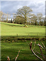
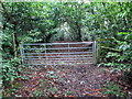
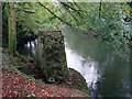


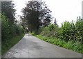
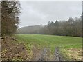
8 photos from this area
Area Information
Key information about the SA32 7NE including its size, population, and administrative classification.
- Area Type
- Postcode
- Area Size
- 69.3 hectares
- Population
- 1396
- Population Density
- 42 people/km²
House Prices in SA32 7NE
27
Properties
£288,714
Average Sold Price
£130,000
Lowest Price
£594,000
Highest Price
Showing 27 properties
| Address | Type | Beds | Baths | Last Sale Price | Last Sale Date | |
|---|---|---|---|---|---|---|
| Orchard House, Alltyferin Road, Pontargothi, Carmarthen, SA32 7NE | Detached | 4 | 3 | £415,000 | Jul 2022 | |
| Sunnymead, Alltyferin Road, Pontargothi, Carmarthen, SA32 7NE | Retail | 3 | 2 | £295,000 | Jul 2022 | |
| Awel Y Coed, Alltyferin Road, Pontargothi, Carmarthen, SA32 7NE | house | - | - | £594,000 | Feb 2022 | |
| Honeystones, Alltyferin Road, Pontargothi, Carmarthen, SA32 7NE | Detached | - | - | £210,000 | Jun 2021 | |
| Cilowen, Alltyferin Road, Pontargothi, Carmarthen, SA32 7NE | Bungalow | - | - | £383,000 | Feb 2021 | |
| Afallon, Alltyferin Road, Pontargothi, Carmarthen, SA32 7NE | Bungalow | 2 | - | £170,000 | Jun 2019 | |
| Treetops, Alltyferin Road, Pontargothi, Carmarthen, SA32 7NE | Bungalow | 3 | 1 | £192,500 | Mar 2019 | |
| Dolcothi, Alltyferin Road, Pontargothi, Carmarthen, SA32 7NE | Detached | 5 | 3 | £430,000 | Mar 2019 | |
| Grove Cottage, Alltyferin Road, Pontargothi, Carmarthen, SA32 7NE | Detached | - | - | £135,000 | Jan 2019 | |
| Maes Cothi, Alltyferin Road, Pontargothi, Carmarthen, SA32 7NE | Detached | 5 | - | £423,000 | Nov 2016 |
Page 1 of 3
Energy Efficiency in SA32 7NE
Amenities
Schools
| Rank | School | Type | Entry gender | Ages |
|---|
Explore more schools in this area
Go to Schools tabDemographics
Household Size
Two person
most common
Accommodation Type
Houses
most common
Tenure
83
majority
Ethnic Group
White
most common
Religion
N/A
most common
Household Composition
N/A
most common
Age
47
median
Adults (30-64 years)
most common
Household Deprivation
N/A
with no deprivation
NS-SEC
40
in Lower managerial occupations
Explore more demographic insights in this area
Go to Demographics tabPlanning
Planning Constraints
- Flood RiskPremium
- Ramsar Wetland SitesPremium
- Area of Outstanding Natural BeautyPremium
- Protected Nature ReservePremium
- Protected WoodlandPremium
- Crime RiskPremium