Area Overview for SA31 1LR
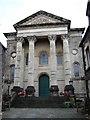
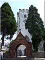
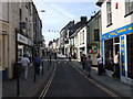
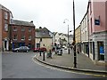
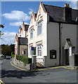
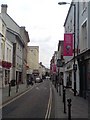
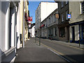
Photos of SA31 1LR


Area Information
Living in SA31 1LR offers a distinct experience within the wider Carmarthen postcode cluster. You are stepping into a very compact residential zone, covering just 7,390 square metres. This small footprint houses a population of 2,063 people, creating a tight-knit environment where neighbours are often familiar faces. The area sits in Wales and functions as a specific residential cluster rather than a vast suburb. Its limited size means that daily commutes to nearby town centres can be quick on foot or by footpath, yet the immediate surroundings remain focused on housing. The density of 1,443 people per square kilometre indicates a space where privacy competes with community proximity. You will find that this postcode is not defined by expansive green belts or industrial zones, but by its concentration of homes in a defined geographic pocket. This makes finding a property here a matter of navigating a specific local grid rather than searching for landmarks across a sprawling landscape.
- Area Type
- Postcode
- Area Size
- 7390 m²
- Population
- 2063
- Population Density
- 1443 people/km²
The property market in SA31 1LR revolves almost entirely around houses. There are no flats listed within the immediate definition of this postcode cluster, so you will not see brick-built apartments or converted lofts when viewing available properties. This restriction means every home transaction involves a standalone house, which aligns with the demographic preference of the adult population aged 30 to 64. Only 35% of homes here are owned outright, leaving a strong presence of rental properties. If you are eyeing a purchase, you must compete with landlords who hold these assets. The small area size of 7,390 square metres restricts the number of listings, creating a micro-market where inventory moves based on local demand rather than regional trends. You should treat this postcode as a specific hunting ground rather than a broad search field. The lack of flats removes the option for buy-to-let investors looking at large blocks, forcing the market to rely on single-family homes. This simplicity can simplify your search but also narrows your options for different household sizes.
House Prices in SA31 1LR
Showing 24 properties
| Address | Type | Beds | Baths | Last Sale Price | Last Sale Date | |
|---|---|---|---|---|---|---|
| 144 Priory Street, Carmarthen, SA31 1LR | Terraced | 7 | 3 | £220,000 | Feb 2004 | |
| 140 Priory Street, Carmarthen, SA31 1LR | Terraced | - | - | £49,000 | Jul 2003 | |
| 135 Priory Street, Carmarthen, SA31 1LR | Flat | 2 | 1 | £75,000 | Apr 2002 | |
| 143A Priory Street, Carmarthen, SA31 1LR | Retail | 1 | 3 | - | - | |
| Top Floor Flat, 137 Priory Street, Carmarthen, SA31 1LR | Flat | - | - | - | - | |
| Flat, 137 Priory Street, Carmarthen, SA31 1LR | Terraced | 11 | - | - | - | |
| Flat 3, 139 Priory Street, Carmarthen, SA31 1LR | Flat | - | - | - | - | |
| Flat 5, 139 Priory Street, Carmarthen, SA31 1LR | Flat | - | - | - | - | |
| Flat 4, 139 Priory Street, Carmarthen, SA31 1LR | Flat | - | - | - | - | |
| Flat 2, 139 Priory Street, Carmarthen, SA31 1LR | Flat | - | - | - | - |
Energy Efficiency in SA31 1LR
Your daily life in SA31 1LR is supported by a practical reach of amenities located in Carmarthen. You have access to five main retail outlets including Co-op, Marks & Spencer (M&S), and Lidl. These venues provide for your grocery needs, clothing shopping, and everyday essentials without requiring a long drive. For travel, Carmarthen Railway Station is just off your doorstep, offering one rail link for getting to larger cities. This arrangement means you combine local convenience with national mobility. The proximity of a major retailer and a railway station defines the lifestyle character here. You can do your dinner shopping at Lidl or M&S before catching a train, blending errands with commutes easily. The lack of named parks or leisure centres in the immediate data suggests your green time might be spent further out, while retail and rail handle your urban needs.
Amenities
Schools
Families considering homes in SA31 1LR will find Carmarthen Christian School as the nearest educational institution listed in the data. This school is categorised as an 'other' type, which distinguishes it from standard primary or secondary mainstream providers. There is no data provided for Ofsted ratings for this specific school within the current source material, so you cannot confirm its regulatory status from this summary alone. The presence of a single school name suggests limited options immediately adjacent to these addresses. Parents may need to travel further to access comprehensive catchment areas for primary or high school education. Knowing only one school is listed means you must verify the actual catchment boundaries for children of all ages. The 'other' classification indicates a specialised or faith-based learning environment rather than a standard state school. This information points to a community where families might need to plan commutes for education more deliberately than in areas with multiple nearby choices.
| Rank | School | Type | Entry gender | Ages |
|---|
Explore more schools in this area
Go to Schools tabDemographics
The community in SA31 1LR is defined by a mature and stable age profile. The median age for residents is 47 years, which places the area firmly in the hands of adults aged between 30 and 64. You will encounter fewer young children or elderly grandparents compared to other regions, reflecting a demographic that has likely settled into long-term homes. Rents and sales here cater to those seeking stability over transient living arrangements. Home ownership stands at 35%, meaning roughly two-thirds of residents pay rent. This figure suggests a mix of private landlords and long-term tenants alongside a significant minority of homeowners. The predominant ethnic group is White, consistent with the broader national patterns for this part of Wales. The accommodation type is exclusively houses, which shapes the local character toward family-led properties rather than high-rise flats or terraced town centres. Knowing these numbers helps you understand that this area is not a student hub or a retiree haven, but a middle-aged family zone with a variable tenure mix.
Household Size
Accommodation Type
Tenure
Ethnic Group
Religion
Household Composition
Age
Household Deprivation
NS-SEC
Explore more demographic insights in this area
Go to Demographics tabPlanning
Planning Constraints
- Flood RiskPremium
- Ramsar Wetland SitesPremium
- Area of Outstanding Natural BeautyPremium
- Protected Nature ReservePremium
- Protected WoodlandPremium
- Crime RiskPremium