Area Overview for SA31 1BS
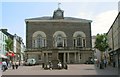
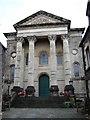
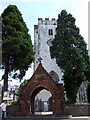
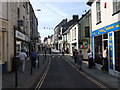
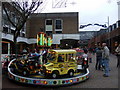
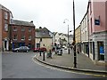
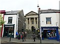
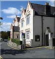
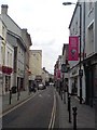
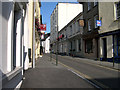
Photos of SA31 1BS


Area Information
Living in SA31 1BS means residing within a tightly defined residential cluster situated in Wales. This specific postcode covers a land area of just 7668 square metres, creating a compact environment where residents live in close proximity to one another. With a population of 2063, the area maintains a density of 1443 people per square kilometre. This density results in a community where neighbours are easily accessible, fostering a local focus that is common in established small villages or urban pockets. You are buying into a location characterised by its contained nature, where the immediate surroundings are well-defined by the boundaries of this single postcode district. The area represents a significant part of a larger locale, offering residents a specific identity that is distinct from the broader city of Carmarthen while remaining functionally connected to it. Daily life here revolves around this central location, allowing for a straightforward commute to essential services and employment hubs nearby. Prospective buyers should view this address as a stable, residential zone defined by its clear physical limits and its specific position within the wider Welsh property market.
- Area Type
- Postcode
- Area Size
- 7668 m²
- Population
- 2063
- Population Density
- 1443 people/km²
The property market in SA31 1BS is characterised by a significant focus on owner-occupied housing. With 35 per cent of households owning their homes, the area displays a mixed leaning, though the presence of houses as the predominant accommodation type suggests a stock suited for families or those seeking permanent residence. This mix indicates a community where residents have invested in their local ties, often stabilising the neighbourhood. Because the accomodation type is primarily houses, buyers here are looking for standalone properties rather than purpose-built blocks or conversions typical of city centres. This structure aligns with the demographic profile of adults aged 30 to 64 years, who often require more space as they raise children or settle into careers. The market is not dominated by student accommodation or short-term lets, reinforcing the residential nature of the postcode. When searching for homes in SA31 1BS, you will find a selection of properties designed for long-term living. The high home ownership rate signals that people who move here tend to stay, reducing turnover and maintaining a consistent character. This stability is a key feature for anyone considering purchasing a property within this specific residential cluster.
House Prices in SA31 1BS
Showing 17 properties
| Address | Type | Beds | Baths | Last Sale Price | Last Sale Date | |
|---|---|---|---|---|---|---|
| 35A King Street, Carmarthen, SA31 1BS | Flat | 2 | 2 | £72,500 | Nov 2000 | |
| Flat, 25 King Street, Carmarthen, SA31 1BS | Flat | 1 | 1 | - | - | |
| Flat 2, 36A King Street, Carmarthen, SA31 1BS | Flat | - | 3 | - | - | |
| REAR BEDSIT, 36 KING STREET, Carmarthen, SA31 1BS | Flat | - | - | - | - | |
| 34A King Street, Carmarthen, SA31 1BS | office_workshop | - | - | - | - | |
| Flat 1, 36A King Street, Carmarthen, SA31 1BS | Flat | - | - | - | - | |
| Flat 3, 36A King Street, Carmarthen, SA31 1BS | Flat | - | - | - | - | |
| Flat 1, 22 King Street, Carmarthen, SA31 1BS | Flat | 1 | 1 | - | - | |
| The Tangled Parrot, First Floor, 32 King Street, Carmarthen, SA31 1BS | shop | - | - | - | - | |
| Maisonette, 38 King Street, Carmarthen, SA31 1BS | Flat | - | - | - | - |
Energy Efficiency in SA31 1BS
Amenities
Schools
Families living near SA31 1BS have access to Carmarthen Christian School as one of their nearest educational options. This institution is classified as an "other" type school, catering to specific educational philosophies or faith-based requirements. The presence of this school alongside other local options means parents have choices beyond the standard comprehensive or primary models found in larger districts. While the data provided only lists Carmarthen Christian School, its proximity suggests it serves a core need for the local family demographic. For those moving into the area, this represents a fixed point of reference for private school settings in the vicinity. The availability of such facilities indicates that the wider catchment area supports diverse educational needs. Families weighing their housing decisions in SA31 1BS must consider travel times to this specific institution, as well as any additional schools not listed in this immediate snapshot but present in the broader Carmarthen region. The school mix reflects the diverse nature of the local population, accommodating different parenting preferences and religious upbringings.
| Rank | School | Type | Entry gender | Ages |
|---|
Explore more schools in this area
Go to Schools tabDemographics
The community within SA31 1BS is defined by a mature population profile. The median age sits at 47 years, indicating that the area attracts adults who are likely settled in their life stages. Most commonly, the residents fall into the 30 to 64 years age range, suggesting a demographic focused on family life or career establishment rather than the teenage or elderly populations found elsewhere. Three hundred and five per cent of households in this area own their homes, reflecting a strong preference for property security over renting accommodation. This high level of home ownership is paired with a housing stock dominated entirely by houses rather than flats, catering to families or individuals seeking higher privacy and space. Most people in SA31 1BS identify as White, aligning with national trends in Wales. The demographic picture is that of a settled community where long-term residents have established roots. This composition means you will encounter neighbours who are likely to be involved in local governance, church groups, or community councils. The area does not attract a transient young professional crowd but rather established families looking for stability in their local environment.
Household Size
Accommodation Type
Tenure
Ethnic Group
Religion
Household Composition
Age
Household Deprivation
NS-SEC
Explore more demographic insights in this area
Go to Demographics tabPlanning
Planning Constraints
- Flood RiskPremium
- Ramsar Wetland SitesPremium
- Area of Outstanding Natural BeautyPremium
- Protected Nature ReservePremium
- Protected WoodlandPremium
- Crime RiskPremium