Area Overview for CF5 4BG
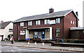
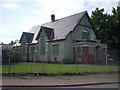
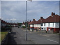
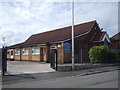
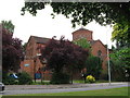
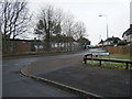
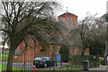
Photos of CF5 4BG
Area Information
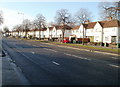
Living in CF5 4BG, a small residential cluster in western Cardiff, Wales, means inhabiting a densely populated area with a population of 1,544 spread over just 2,849 square metres. This compact postcode sits within Ely, a historic district shaped by 1920s-1930s council housing developments. The area’s proximity to the River Ely and its mix of 1930s-era housing estates define its character. While the high population density—541,891 people per square kilometre—suggests a tightly knit community, the area’s legacy includes historical challenges such as high unemployment and social unrest in the 1990s. Today, residents benefit from modern infrastructure, including rail links and digital connectivity, though the area remains one of Cardiff’s more complex suburbs. For those seeking a compact, suburban environment with a mix of practical amenities and historical context, CF5 4BG offers a distinct blend of proximity and complexity.
- Area Type
- Postcode
- Area Size
- 2849 m²
- Population
- 1544
- Population Density
- 5378 people/km²
The property market in CF5 4BG is defined by its 43% home ownership rate, with houses making up the predominant accommodation type. This suggests a mix of owner-occupied properties and rental units, though the small area size—just 2,849 square metres—limits the availability of new housing stock. The focus on houses rather than flats or apartments may appeal to families or those seeking more space. However, the high population density and historical context of council housing mean that property values and availability are likely constrained by the area’s compact footprint. Buyers considering CF5 4BG should factor in the limited scope for expansion and the need to balance proximity to amenities with the area’s legacy of social challenges. The immediate surroundings offer few alternatives, making the local market particularly sensitive to demand.
House Prices in CF5 4BG
Showing 10 properties
| Address | Type | Beds | Baths | Last Sale Price | Last Sale Date | |
|---|---|---|---|---|---|---|
| 4 Maureen Avenue, Ely, Cardiff, CF5 4BG | Terraced | 2 | - | £42,000 | Oct 2002 | |
| 6 Maureen Avenue, Ely, Cardiff, CF5 4BG | house | - | - | - | - | |
| 2 Maureen Avenue, Ely, Cardiff, CF5 4BG | Terraced | 2 | - | - | - | |
| 9 Maureen Avenue, Ely, Cardiff, CF5 4BG | house | - | - | - | - | |
| 8 Maureen Avenue, Ely, Cardiff, CF5 4BG | house | - | - | - | - | |
| 3 Maureen Avenue, Ely, Cardiff, CF5 4BG | house | - | - | - | - | |
| 1 Maureen Avenue, Ely, Cardiff, CF5 4BG | house | - | - | - | - | |
| 10 Maureen Avenue, Ely, Cardiff, CF5 4BG | Semi-detached | - | - | - | - | |
| 5 Maureen Avenue, Ely, Cardiff, CF5 4BG | house | - | - | - | - | |
| 7 Maureen Avenue, Ely, Cardiff, CF5 4BG | Terraced | - | - | - | - |
Energy Efficiency in CF5 4BG
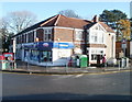
The lifestyle in CF5 4BG is shaped by its proximity to retail, transport, and natural features. Nearby shops include Farmfoods Ely, Aldi Treseder, and Co-op Fairwater, offering everyday essentials within practical reach. The area’s rail links, such as Waun and Fairwater stations, connect residents to Cardiff’s urban core, while waterbus stops provide access to the River Ely and surrounding waterways. The River Ely itself adds a natural element, with Trelai Park nearby offering green space for leisure. The presence of multiple retail outlets and transport hubs suggests a convenient, if compact, lifestyle. However, the area’s historical character—marked by 1930s housing and industrial remnants—adds a layer of heritage to daily life. While amenities are accessible, the high population density means residents must balance proximity with the need for personal space and community resources.
Amenities
Schools
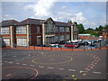
Residents of CF5 4BG have access to three schools within the area: Herbert Thompson Infant School, Herbert Thompson Junior School, and Herbert Thompson Primary. These institutions cater to early years through primary education, providing a continuous pathway for local children. While the data does not specify Ofsted ratings, the presence of three distinct schools suggests a focus on foundational education. Families may benefit from the proximity of these schools, though the lack of secondary education options in the immediate vicinity could require commuting. The concentration of primary schools reflects the area’s demographic profile, with a significant proportion of the population in the 30–64 age range, likely including school-age children. For parents, the availability of multiple schools within walking distance offers convenience but may also indicate a reliance on local infrastructure.
| Rank | School | Type | Entry gender | Ages |
|---|
Explore more schools in this area
Go to Schools tabDemographics
The community in CF5 4BG is predominantly composed of adults aged 30–64, with a median age of 47. Home ownership here stands at 43%, indicating a mix of owner-occupied and rental properties. The accommodation type is primarily houses, reflecting the area’s post-war housing developments. The predominant ethnic group is White, though specific data on diversity or deprivation is not provided. The age profile suggests a mature population, which may influence local services and community dynamics. With a population density over half a million per square kilometre, the area’s compact size fosters close proximity between residents, though this density also underscores the need for efficient planning and resource allocation. The demographic profile highlights a settled, middle-aged population, which may shape the area’s social and economic character.
Household Size
Accommodation Type
Tenure
Ethnic Group
Religion
Household Composition
Age
Household Deprivation
NS-SEC
Explore more demographic insights in this area
Go to Demographics tabPlanning
Planning Constraints
- Flood RiskPremium
- Ramsar Wetland SitesPremium
- Area of Outstanding Natural BeautyPremium
- Protected Nature ReservePremium
- Protected WoodlandPremium
- Crime RiskPremium