Area Overview for CF5 4BB
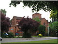
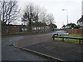
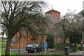
Photos of CF5 4BB
Area Information
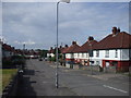
CF5 4BB is a small, densely populated postcode area in western Cardiff, Wales, covering 8,520 square metres and home to 1,544 residents. Its high population density of 181,214 people per square kilometre reflects a compact, suburban layout shaped by post-war council housing developments. Historically, the area evolved from a 19th-century hamlet near the River Ely into a Cardiff suburb by 1922, with its character defined by 1920s-1930s housing estates. Today, it is bordered by the River Ely to the west and sits near the A48, offering access to the M4 motorway within 10–15 minutes. While the area has faced challenges, including historical crime issues and high unemployment in the 1990s, it remains a practical choice for those seeking affordable housing close to transport links and local amenities. Its proximity to the River Ely and nearby green spaces like Trelai Park provide a contrast to its urban density, though the community’s reputation as one of Cardiff’s less desirable areas persists.
- Area Type
- Postcode
- Area Size
- 8520 m²
- Population
- 1544
- Population Density
- 5378 people/km²
The property market in CF5 4BB is characterised by a 43% home ownership rate, indicating that the majority of properties are rented. This suggests a rental-dominated market, which may appeal to buyers seeking investment opportunities or those prioritising affordability. The accommodation type is predominantly houses, which is notable in a high-density area, potentially offering more space than typical urban flats. However, the small area size and limited housing stock mean competition for buyers is likely. The presence of council housing from the 1920s–1930s suggests a mix of older properties, which may require modernisation. For buyers, this area could be a practical choice for those seeking a house in a suburban setting, though the high population density and historical challenges may influence long-term value.
House Prices in CF5 4BB
Showing 30 properties
| Address | Type | Beds | Baths | Last Sale Price | Last Sale Date | |
|---|---|---|---|---|---|---|
| 40 Heol Muston, Ely, Cardiff, CF5 4BB | Semi-detached | 3 | 1 | £190,000 | Nov 2023 | |
| 50 Heol Muston, Ely, Cardiff, CF5 4BB | Retail | 3 | 2 | £201,500 | Mar 2022 | |
| 34 Heol Muston, Ely, Cardiff, CF5 4BB | Terraced | - | - | £158,000 | Mar 2021 | |
| 52 Heol Muston, Ely, Cardiff, CF5 4BB | Semi-detached | 3 | 1 | £132,500 | Aug 2018 | |
| 59 Heol Muston, Ely, Cardiff, CF5 4BB | house | 3 | - | £90,000 | Feb 2012 | |
| 55 Heol Muston, Ely, Cardiff, CF5 4BB | house | 3 | - | £89,000 | Nov 2004 | |
| 46 Heol Muston, Ely, Cardiff, CF5 4BB | house | - | - | £76,950 | Jun 2003 | |
| 38 Heol Muston, Ely, Cardiff, CF5 4BB | house | 3 | - | £38,000 | Jun 1998 | |
| 63 Heol Muston, Ely, Cardiff, CF5 4BB | Terraced | 3 | 1 | - | - | |
| 33 Heol Muston, Ely, Cardiff, CF5 4BB | house | - | - | - | - |
Energy Efficiency in CF5 4BB
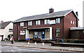
Residents of CF5 4BB have access to a range of local amenities, including five retail stores such as Aldi Treseder, Farmfoods Ely, and Co-op Fairwater, which cater to everyday shopping needs. The area’s rail network, with stations like Waun and Fairwater, connects to broader transport systems, while ferry stops provide water-based travel options. The nearby Cardiff Bus Interchange offers further connectivity. For leisure, the River Ely and Trelai Park offer green space, though the area’s historical industrial sites, such as the former Ely Brewery and Ely Racecourse, are now largely decommissioned. The compact nature of the area means amenities are within practical reach, though the absence of major leisure facilities or dining options beyond basic retail may require trips to nearby districts for more varied experiences.
Amenities
Schools
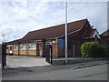
Residents of CF5 4BB have access to three primary schools: Herbert Thompson Junior School, Herbert Thompson Infant School, and Herbert Thompson Primary. These institutions cater to early and primary education, though no Ofsted ratings are provided in the data. The presence of three schools within the area suggests a focus on local education, potentially reducing the need for long commutes. However, the lack of secondary schools or specific performance metrics means families may need to look beyond CF5 4BB for comprehensive schooling. The clustering of primary schools could benefit families with young children, but the absence of detailed quality assessments leaves room for further inquiry into educational standards.
| Rank | School | Type | Entry gender | Ages |
|---|
Explore more schools in this area
Go to Schools tabDemographics
The population of CF5 4BB has a median age of 47, with the majority of residents aged 30–64. This suggests a community skewed towards middle-aged adults and families, though the 43% home ownership rate indicates that over half of households are renters. The predominant accommodation type is houses, which is unusual for a high-density area, implying a mix of family homes and smaller properties. The White ethnic group constitutes the majority, with no specific data on other demographics. The high population density of 181,214 people per square kilometre suggests tightly packed housing, which may impact living space and community dynamics. While the area’s age profile and housing stock suggest a stable, working-age population, the lack of detailed diversity data limits understanding of broader social composition.
Household Size
Accommodation Type
Tenure
Ethnic Group
Religion
Household Composition
Age
Household Deprivation
NS-SEC
Explore more demographic insights in this area
Go to Demographics tabPlanning
Planning Constraints
- Flood RiskPremium
- Ramsar Wetland SitesPremium
- Area of Outstanding Natural BeautyPremium
- Protected Nature ReservePremium
- Protected WoodlandPremium
- Crime RiskPremium