Area Overview for CF14 7ZB
Photos of CF14 7ZB
Area Information
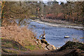
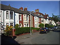
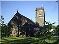
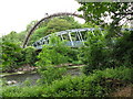
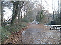
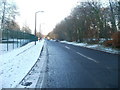
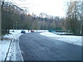
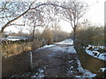
CF14 7ZB is a compact residential postcode in north-west Cardiff, Wales, encompassing a small cluster of homes with a population of 1,633. The area spans 3.6 hectares, translating to a high population density of 1,201 people per square kilometre. Its history is deeply rooted in medieval times, with St. Mary’s chapel—originally known as the “white chapel”—giving the area its name. Today, the parish of Whitchurch, which includes CF14 7ZB, retains echoes of its past as a grain mill and Norman fortress, though its modern identity is defined by its proximity to the River Taff and its role as a commuter hub. Residents benefit from a mix of historical landmarks, such as Castell Coch (the Red Castle), and practical amenities. The area’s small size means it is tightly knit, with a focus on local connectivity. While it lacks large-scale infrastructure, its proximity to rail, retail, and water transport options makes it appealing for those seeking a balance between urban convenience and a quieter residential setting.
- Area Type
- Postcode
- Area Size
- 3.6 hectares
- Population
- 1633
- Population Density
- 1201 people/km²
CF14 7ZB’s property market is characterised by a 47% home ownership rate, indicating that nearly half of the area’s housing stock is rented. The predominance of flats suggests a focus on smaller, manageable properties, likely catering to individuals or couples rather than larger families. This configuration may reflect the area’s compact size and historical development as a residential cluster. For buyers, the small postcode area means limited housing options, with properties likely concentrated around key local hubs such as Radyr Railway Station. The flat-dominated market may appeal to those seeking low-maintenance living, but the relatively low home ownership rate could signal a reliance on rental availability. Prospective buyers should consider the area’s proximity to transport links and amenities, which may offset its smaller scale. However, the lack of data on property prices or recent developments means further local research is advisable for a comprehensive market analysis.
House Prices in CF14 7ZB
No properties found in this postcode.
Energy Efficiency in CF14 7ZB
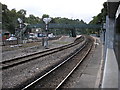
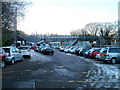
Daily life in CF14 7ZB is shaped by its proximity to key amenities, including five rail stations and three waterbus stops, which facilitate easy travel to Cardiff’s central districts. Retail choices are varied, with major supermarkets like Morrisons, Co-op, and Asda within reach, catering to both routine shopping and larger purchases. The area’s historical roots are complemented by its practical modern offerings, such as the Cardiff Bus Interchange, which connects residents to broader transport networks. While the data does not specify parks or leisure facilities, the presence of landmarks like Castell Coch and the River Taff suggests opportunities for outdoor recreation. The compact nature of the area means amenities are concentrated, which can enhance convenience but may limit access to specialist services. Overall, CF14 7ZB offers a blend of historical character and functional connectivity, ideal for those prioritising ease of movement and local accessibility.
Amenities
Schools
The nearest school to CF14 7ZB is Coryton Primary School, which is categorised as an “other” type in the data. No Ofsted rating is provided, so its academic performance remains unspecified. As a primary school, it would serve the needs of young families in the area, though the absence of secondary education options nearby may require commuting. The single listed school suggests a limited range of educational choices, which could be a consideration for families prioritising school diversity. Without additional data on school catchment areas or performance metrics, it is unclear how well Coryton Primary School meets the needs of the local community. Prospective residents should verify school admissions policies and consider the broader educational landscape beyond CF14 7ZB.
| Rank | School | Type | Entry gender | Ages |
|---|
Explore more schools in this area
Go to Schools tabDemographics
The population of CF14 7ZB is predominantly adults aged 30–64, with a median age of 47. Home ownership stands at 47%, suggesting a mix of owner-occupied and rental properties. The accommodation type is primarily flats, reflecting a housing stock suited to smaller households or those preferring low-maintenance living. The predominant ethnic group is White, though the data does not specify further diversity metrics. The area’s high population density—1,201 people per square kilometre—implies a compact, possibly multi-generational community. This density may influence local services and amenities, though the absence of detailed deprivation data means it is unclear how this affects quality of life. The age profile suggests a mature demographic, potentially with established careers and families, though the lack of data on younger residents or children’s proportions limits a full picture of the community’s dynamics.
Household Size
Accommodation Type
Tenure
Ethnic Group
Religion
Household Composition
Age
Household Deprivation
NS-SEC
Explore more demographic insights in this area
Go to Demographics tabPlanning
Planning Constraints
- Flood RiskPremium
- Ramsar Wetland SitesPremium
- Area of Outstanding Natural BeautyPremium
- Protected Nature ReservePremium
- Protected WoodlandPremium
- Crime RiskPremium