Area Overview for CF14 7HY
Photos of CF14 7HY
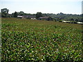
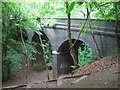
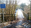
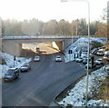
100 photos from this area
Area Information
Key information about the CF14 7HY including its size, population, and administrative classification.
- Area Type
- Postcode
- Area Size
- 21.0 hectares
- Population
- 1633
- Population Density
- 1201 people/km²
House Prices in CF14 7HY
4
Properties
-
Average Sold Price
-
Lowest Price
-
Highest Price
Showing 4 properties
| Address | Type | Beds | Baths | Last Sale Price | Last Sale Date | |
|---|---|---|---|---|---|---|
| Starbucks, Longwood Drive, Whitchurch, Cardiff, CF14 7HY | restaurant_cafe | - | - | - | - | |
| Mcdonald's, Longwood Drive, Whitchurch, Cardiff, CF14 7HY | restaurant_cafe | - | - | - | - | |
| Global Life Sciences Solutions Manufacturing Uk Ltd, Unit 1A, Longwood Drive, Whitchurch, Cardiff, CF14 7HY | warehouse | - | - | - | - | |
| Car Wash, Asda Filling Station, Longwood Drive, Whitchurch, Cardiff, CF14 7HY | Retail | - | - | - | - |
Energy Efficiency in CF14 7HY
Amenities
Schools
| Rank | School | Type | Entry gender | Ages |
|---|
Explore more schools in this area
Go to Schools tabDemographics
Household Size
One person
most common
Accommodation Type
Flats
most common
Tenure
47
majority
Ethnic Group
White
most common
Religion
N/A
most common
Household Composition
N/A
most common
Age
47
median
Adults (30-64 years)
most common
Household Deprivation
N/A
with no deprivation
NS-SEC
38
in Lower managerial occupations
Explore more demographic insights in this area
Go to Demographics tabPlanning
Planning Constraints
- Flood RiskPremium
- Ramsar Wetland SitesPremium
- Area of Outstanding Natural BeautyPremium
- Protected Nature ReservePremium
- Protected WoodlandPremium
- Crime RiskPremium