Area Overview for CF14 2AN
Photos of CF14 2AN
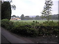
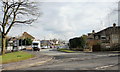

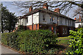
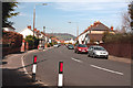

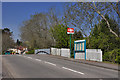
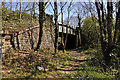
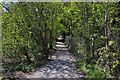
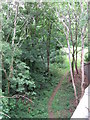
100 photos from this area
Area Information
Key information about the CF14 2AN including its size, population, and administrative classification.
- Area Type
- Postcode
- Area Size
- 1.1 hectares
- Population
- 1622
- Population Density
- 3870 people/km²
House Prices in CF14 2AN
36
Properties
£296,780
Average Sold Price
£70,000
Lowest Price
£538,000
Highest Price
Showing 36 properties
| Address | Type | Beds | Baths | Last Sale Price | Last Sale Date | |
|---|---|---|---|---|---|---|
| 11 Velindre Place, Whitchurch, Cardiff, CF14 2AN | house | 3 | 1 | £538,000 | May 2025 | |
| 4 Velindre Place, Whitchurch, Cardiff, CF14 2AN | Semi-detached | 3 | 1 | £490,000 | Aug 2023 | |
| 30 Velindre Place, Whitchurch, Cardiff, CF14 2AN | house | - | - | £440,000 | Nov 2022 | |
| 18 Velindre Place, Whitchurch, Cardiff, CF14 2AN | house | - | - | £342,000 | Oct 2022 | |
| 7 Velindre Place, Whitchurch, Cardiff, CF14 2AN | Terraced | 3 | 1 | £350,000 | Feb 2021 | |
| 28 Velindre Place, Whitchurch, Cardiff, CF14 2AN | house | - | - | £300,000 | Feb 2021 | |
| 2 Velindre Place, Whitchurch, Cardiff, CF14 2AN | house | - | - | £435,000 | Jan 2021 | |
| 25 Velindre Place, Whitchurch, Cardiff, CF14 2AN | house | - | - | £345,000 | Mar 2019 | |
| 9 Velindre Place, Whitchurch, Cardiff, CF14 2AN | Terraced | 3 | 1 | £305,000 | Oct 2017 | |
| 15 Velindre Place, Whitchurch, Cardiff, CF14 2AN | house | - | - | £308,000 | Dec 2016 |
Page 1 of 4
Energy Efficiency in CF14 2AN
Amenities
Schools
| Rank | School | Type | Entry gender | Ages |
|---|
Explore more schools in this area
Go to Schools tabDemographics
Household Size
Family (3-5 people)
most common
Accommodation Type
Houses
most common
Tenure
91
majority
Ethnic Group
White
most common
Religion
N/A
most common
Household Composition
N/A
most common
Age
47
median
Adults (30-64 years)
most common
Household Deprivation
N/A
with no deprivation
NS-SEC
59
in Lower managerial occupations
Explore more demographic insights in this area
Go to Demographics tabPlanning
Planning Constraints
- Flood RiskPremium
- Ramsar Wetland SitesPremium
- Area of Outstanding Natural BeautyPremium
- Protected Nature ReservePremium
- Protected WoodlandPremium
- Crime RiskPremium