Area Overview for CF14 2AJ
Photos of CF14 2AJ
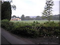
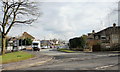
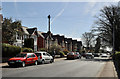
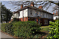
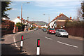

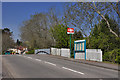
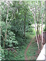
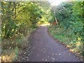
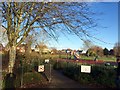
100 photos from this area
Area Information
Key information about the CF14 2AJ including its size, population, and administrative classification.
- Area Type
- Postcode
- Area Size
- 8579 m²
- Population
- 1622
- Population Density
- 3870 people/km²
House Prices in CF14 2AJ
19
Properties
£293,250
Average Sold Price
£73,500
Lowest Price
£570,000
Highest Price
Showing 19 properties
| Address | Type | Beds | Baths | Last Sale Price | Last Sale Date | |
|---|---|---|---|---|---|---|
| 34 Kelston Road, Whitchurch, Cardiff, CF14 2AJ | Semi-detached | 3 | 1 | £526,000 | Jan 2025 | |
| 32 Kelston Road, Whitchurch, Cardiff, CF14 2AJ | house | 3 | - | £530,000 | Dec 2022 | |
| 22 Kelston Road, Whitchurch, Cardiff, CF14 2AJ | Bungalow | - | - | £570,000 | Jun 2021 | |
| 36 Kelston Road, Whitchurch, Cardiff, CF14 2AJ | house | - | - | £420,000 | Oct 2019 | |
| 18 Kelston Road, Whitchurch, Cardiff, CF14 2AJ | Semi-detached | 3 | - | £345,000 | Oct 2015 | |
| 26 Kelston Road, Whitchurch, Cardiff, CF14 2AJ | Semi-detached | - | - | £246,000 | Jul 2008 | |
| 28 Kelston Road, Whitchurch, Cardiff, CF14 2AJ | house | - | - | £295,000 | Aug 2004 | |
| 20 Kelston Road, Whitchurch, Cardiff, CF14 2AJ | Semi-detached | - | - | £198,500 | Sep 2003 | |
| 14 Kelston Road, Whitchurch, Cardiff, CF14 2AJ | Semi-detached | - | - | £125,000 | Aug 2000 | |
| 8 Kelston Road, Whitchurch, Cardiff, CF14 2AJ | Semi-detached | - | - | £73,500 | Dec 1996 |
Page 1 of 2
Energy Efficiency in CF14 2AJ
Amenities
Schools
| Rank | School | Type | Entry gender | Ages |
|---|
Explore more schools in this area
Go to Schools tabDemographics
Household Size
Family (3-5 people)
most common
Accommodation Type
Houses
most common
Tenure
91
majority
Ethnic Group
White
most common
Religion
N/A
most common
Household Composition
N/A
most common
Age
47
median
Adults (30-64 years)
most common
Household Deprivation
N/A
with no deprivation
NS-SEC
59
in Lower managerial occupations
Explore more demographic insights in this area
Go to Demographics tabPlanning
Planning Constraints
- Flood RiskPremium
- Ramsar Wetland SitesPremium
- Area of Outstanding Natural BeautyPremium
- Protected Nature ReservePremium
- Protected WoodlandPremium
- Crime RiskPremium