Area Overview for CF11 8UU
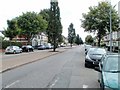
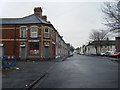
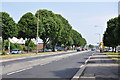
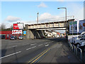
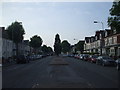
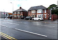
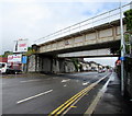
Photos of CF11 8UU

Area Information
Living in CF11 8UU, a small residential cluster in Cardiff, Wales, means inhabiting a compact, densely populated area with a distinct historical character. The postcode covers just 1.1 hectares, housing 1,732 residents in a high-density arrangement of 1,410 people per square kilometre. Situated south of Cardiff’s city centre, the area lies between the River Taff and River Ely, with roots tracing back to the 12th century as a monastic grange. Its development into a residential suburb began in the 19th century, shaped by industrial growth and transport links. Today, CF11 8UU is defined by its proximity to retail hubs like Lidl Cardiff and Tesco Grangetown, as well as rail and ferry connections that integrate it into Cardiff’s broader network. The community here is primarily composed of adults aged 30–64, with a median age of 47, reflecting a mature demographic. While the area lacks large green spaces, its compact size ensures amenities are within easy reach, making it a practical choice for those prioritising convenience over open space.
- Area Type
- Postcode
- Area Size
- 1.1 hectares
- Population
- 1732
- Population Density
- 1410 people/km²
The property market in CF11 8UU is characterised by a low home ownership rate of 38%, with flats making up the majority of accommodation types. This suggests that the area functions more as a rental market than a primary owner-occupied zone, which is common in urbanised, high-density environments. The limited area size of 1.1 hectares means the housing stock is constrained, with few new developments likely to emerge. For buyers, this presents challenges: the small footprint limits property availability, and the focus on flats may appeal more to those seeking affordability or proximity to amenities over spacious living. The area’s compact nature also means that property prices are likely influenced heavily by proximity to transport links and retail hubs like Tesco Grangetown. Buyers should consider whether the trade-off between density and space aligns with their needs, particularly if they prioritise larger homes or private outdoor areas.
House Prices in CF11 8UU
No properties found in this postcode.
Energy Efficiency in CF11 8UU
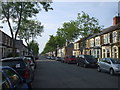
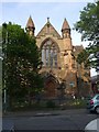
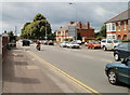
Life in CF11 8UU is shaped by its proximity to essential amenities and historical character. Retail options include Lidl Cardiff, Iceland Cardiff, and Tesco Grangetown, ensuring daily needs are met within walking distance. The area’s transport links, such as Ninian Park Railway Station and Taffs Mead Waterbus Stop, provide easy access to Cardiff’s cultural and commercial hubs. While parks and leisure facilities are not explicitly listed in the data, the area’s riverside location and historical sites like The Grange, an 800-year-old building, add to its charm. The Grange National School, established in 1864, serves local families, and streets like Holmesdale and Kent reflect the 19th-century development of the suburb. The compact layout means residents can walk or cycle to most destinations, fostering a sense of community. While the area lacks expansive green spaces, its density and accessibility make it practical for those seeking convenience over isolation.
Amenities
Schools
| Rank | School | Type | Entry gender | Ages |
|---|
Explore more schools in this area
Go to Schools tabDemographics
CF11 8UU has a median age of 47, with the majority of residents falling within the 30–64 age range. This suggests a community of working-age adults and older individuals, likely with established careers and families. Home ownership is relatively low at 38%, indicating that a significant proportion of the population rents their homes. The accommodation type is predominantly flats, reflecting the area’s urban density and historical development as a residential suburb. The predominant ethnic group is White, though specific data on diversity is not provided. The high population density of 1,410 people per square kilometre means the area is closely packed, which can influence the pace of life and availability of communal spaces. While this density supports a vibrant, interconnected community, it also means resources and services are shared among a large population. The demographic profile suggests a stable, mature community with a focus on practical living rather than expansive housing.
Household Size
Accommodation Type
Tenure
Ethnic Group
Religion
Household Composition
Age
Household Deprivation
NS-SEC
Explore more demographic insights in this area
Go to Demographics tabPlanning
Planning Constraints
- Flood RiskPremium
- Ramsar Wetland SitesPremium
- Area of Outstanding Natural BeautyPremium
- Protected Nature ReservePremium
- Protected WoodlandPremium
- Crime RiskPremium