Area Overview for CF1 7RP
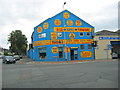
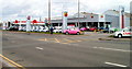
Photos of CF1 7RP
Area Information
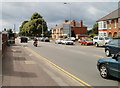
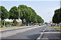
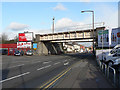
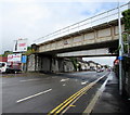
Grangetown, captured within the CF1 7RP postcode, is a residential cluster characterised by high density and a distinct urban history. You are buying into an area with a population of 1,732 residents living at a density of 1,410 people per square kilometre. This postcode sits south of Cardiff city centre, bordered by the River Taff and the River Ely. The location offers immediate proximity to major transport links, including Grangetown, Ninian Park, and Cardiff Central Railway Stations, alongside several waterbus stops like Channel View and Clarence Embankment. Historically, the land began as a monastic grange granted to Margam Abbey in the 12th century before evolving into housing after 1850. Today, you can walk to large supermarkets such as Lidl, Iceland, and Asda, all located within practical reach of residents. The area combines historical significance, such as the building at Clive Street known as The Grange, with modern connectivity. Living in CF1 7RP means accessing a location that has transitioned from marshy farming land to a compact suburb with 85 per cent of the postcode falling under a high-quality mobile network rating. You benefit from being close to the Cardiff Bus Interchange without the sprawl of larger districts. This compact nature defines your daily commute, making it a practical choice for those working in the city or relying on public transport networks.
- Area Type
- Postcode
- Area Size
- Not available
- Population
- 1732
- Population Density
- 1410 people/km²
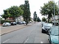
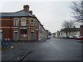
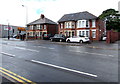
Homes in CF1 7RP are defined by a clear predominance of flats, a fact that shapes the entire character of the local property market. The accommodation type data confirms that flats are the primary dwelling structure in this postcode. You should approach this area with the understanding that seeking a detached or semi-detached house within these specific boundaries may yield very limited options. The level of home ownership is 38 per cent, meaning that while there is a substantial base of owner-occupiers, the majority of homes here are rented out. This dynamic often points to an urban redevelopment context where investment buyers or those seeking mobility prefer flats in central locations. When you look at neighbouring areas on Penarth Road, the influence of the original brickworks and marshy land history continues to shape the available building styles. The boundary you are currently viewing covers a small residential cluster, so your search for properties will be intense and competitive due to the limited land area. Understanding that the stock consists primarily of flats allows you to narrow your focus to positive ground-floor conversions or modern blocks situated near the riverside. This concentration of flat housing supports a rental yield-focused market as well as a buyer market for those wishing to downsize or invest in city-centre living.
House Prices in CF1 7RP
No properties found in this postcode.
Energy Efficiency in CF1 7RP
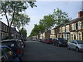
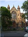
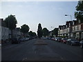
Your daily life in CF1 7RP centres on a mix of urban convenience and historical character. You will find essential shopping within walking distance, with Lidl, Iceland, and Asda Cardiff all falling under the retail amenities available to residents. Public transport is integrated into your routine, offering connections at Grangetown, Ninian Park, and Cardiff Central Railway Stations. The Cardiff Bus Interchange is nearby, linking you to wider travel networks. Water travel is another practical option, with stops at Channel View, Clarence Embankment, and Taffs Mead providing travel on the River Taff. The area retains historical landmarks like The Grange, an 800-year-old building at the Clive Street and Stockland Street junction, which you can visit while taking a break from your day. Early streets like Holmesdale, Kent, and Worcester reflect the area's 19th-century development, adding visual interest to your walk. You do not need to travel far for essential grocery shopping, as three major supermarkets are operationally close. The proximity to the River Taff and River Ely defines your local landscape, offering green spaces and walking paths. Living in this part of Grangetown means balancing the quiet of historical streets with the activity of nearby transport hubs. The presence of schools like Grange National School, which opened in 1864, adds to the educational fabric of the area without overwhelming the residential nature of the postcode.
Amenities
Schools
| Rank | School | Type | Entry gender | Ages |
|---|
Explore more schools in this area
Go to Schools tabDemographics
The community within CF1 7RP reflects a mature population with a median age of 47 years. Most residents are adults between 30 and 64 years old, creating a neighbourhood defined by stability. Home ownership stands at 38 per cent, indicating that a significant portion of the area is let to tenants rather than being owned outright by the people living there. The predominant accommodation type consists of flats, which aligns with the high population density of 1,410 people per square kilometre. The predominant ethnic group in this postcode is White. This demographic profile suggests a living environment focused on established households rather than young families or students. With 62 per cent of homes being rented, the area functions partly as a rental corridor while maintaining a majority of adult residents. The flat-based housing stock means neighbours are often closer together, fostering a sense of shared urban community. When you consider the age profile, you are entering a local scene where decision-making regarding local services or housing purchases likely involves longer-term residents. The concentration of flats explains why 38 per cent of these residents own their homes, while the remaining majority rent their accommodations within this specific postcode boundary.
Household Size
Accommodation Type
Tenure
Ethnic Group
Religion
Household Composition
Age
Household Deprivation
NS-SEC
Explore more demographic insights in this area
Go to Demographics tabPlanning
Planning Constraints
- Flood RiskPremium
- Ramsar Wetland SitesPremium
- Area of Outstanding Natural BeautyPremium
- Protected Nature ReservePremium
- Protected WoodlandPremium
- Crime RiskPremium