Area Overview for CF11 7JL
Photos of CF11 7JL
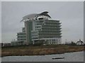
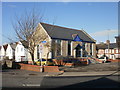
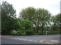

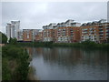


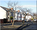
100 photos from this area
Area Information
Key information about the CF11 7JL including its size, population, and administrative classification.
- Area Type
- Postcode
- Area Size
- 2.5 hectares
- Population
- 1328
- Population Density
- 5108 people/km²
House Prices in CF11 7JL
43
Properties
£145,126
Average Sold Price
£104,950
Lowest Price
£249,950
Highest Price
Showing 43 properties
| Address | Type | Beds | Baths | Last Sale Price | Last Sale Date | |
|---|---|---|---|---|---|---|
| 65 Jim Driscoll Way, Grangetown, Cardiff, CF11 7JL | Flat | 2 | 2 | £165,000 | Aug 2025 | |
| 43 Jim Driscoll Way, Grangetown, Cardiff, CF11 7JL | Flat | 2 | 2 | £157,500 | Aug 2025 | |
| 68 Jim Driscoll Way, Grangetown, Cardiff, CF11 7JL | Flat | - | - | £185,000 | Sep 2024 | |
| 40 Jim Driscoll Way, Grangetown, Cardiff, CF11 7JL | Maisonette | 2 | - | £120,000 | Feb 2024 | |
| 32 Jim Driscoll Way, Grangetown, Cardiff, CF11 7JL | Flat | 2 | 1 | £150,000 | Jun 2023 | |
| 58 Jim Driscoll Way, Grangetown, Cardiff, CF11 7JL | Flat | 1 | 1 | £125,000 | May 2023 | |
| 56 Jim Driscoll Way, Grangetown, Cardiff, CF11 7JL | Flat | - | - | £170,000 | Dec 2022 | |
| 61 Jim Driscoll Way, Grangetown, Cardiff, CF11 7JL | Maisonette | 1 | 1 | £115,000 | Sep 2022 | |
| 48 Jim Driscoll Way, Grangetown, Cardiff, CF11 7JL | Flat | 1 | 1 | £145,000 | Jul 2022 | |
| 38 Jim Driscoll Way, Grangetown, Cardiff, CF11 7JL | Maisonette | - | - | £127,500 | Jun 2022 |
Page 1 of 5
Energy Efficiency in CF11 7JL
Amenities
Schools
| Rank | School | Type | Entry gender | Ages |
|---|
Explore more schools in this area
Go to Schools tabDemographics
Household Size
One person
most common
Accommodation Type
Flats
most common
Tenure
29
majority
Ethnic Group
White
most common
Religion
N/A
most common
Household Composition
N/A
most common
Age
47
median
Adults (30-64 years)
most common
Household Deprivation
N/A
with no deprivation
NS-SEC
31
in Lower managerial occupations
Explore more demographic insights in this area
Go to Demographics tabPlanning
Planning Constraints
- Flood RiskPremium
- Ramsar Wetland SitesPremium
- Area of Outstanding Natural BeautyPremium
- Protected Nature ReservePremium
- Protected WoodlandPremium
- Crime RiskPremium