Area Overview for CF82 8LB
Photos of CF82 8LB
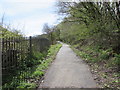
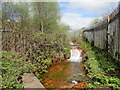
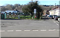
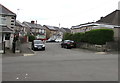
65 photos from this area
Area Information
Key information about the CF82 8LB including its size, population, and administrative classification.
- Area Type
- Postcode
- Area Size
- 9076 m²
- Population
- 1386
- Population Density
- 2214 people/km²
House Prices in CF82 8LB
24
Properties
£119,562
Average Sold Price
£38,500
Lowest Price
£272,500
Highest Price
Showing 24 properties
| Address | Type | Beds | Baths | Last Sale Price | Last Sale Date | |
|---|---|---|---|---|---|---|
| 23 Ramson Close, Penpedairheol, CF82 8LB | Detached | 3 | 3 | £272,500 | Dec 2025 | |
| 17 Ramson Close, Penpedairheol, CF82 8LB | house | - | - | £155,000 | Sep 2025 | |
| 5 Ramson Close, Penpedairheol, CF82 8LB | Terraced | 2 | 1 | £135,000 | Feb 2025 | |
| 14 Ramson Close, Penpedairheol, CF82 8LB | Terraced | 3 | 2 | £225,000 | Dec 2024 | |
| 22 Ramson Close, Penpedairheol, CF82 8LB | Detached | 3 | 2 | £262,500 | May 2024 | |
| 6 Ramson Close, Penpedairheol, CF82 8LB | Terraced | 2 | 1 | £163,000 | Apr 2023 | |
| 15 Ramson Close, Penpedairheol, CF82 8LB | Terraced | 2 | 1 | £146,500 | Jun 2022 | |
| 1 Ramson Close, Penpedairheol, CF82 8LB | Terraced | 2 | - | £228,000 | Jun 2021 | |
| 13 Ramson Close, Penpedairheol, CF82 8LB | house | - | - | £175,000 | Oct 2020 | |
| 7 Ramson Close, Penpedairheol, CF82 8LB | house | 2 | 1 | £125,000 | Apr 2020 |
Page 1 of 3
Energy Efficiency in CF82 8LB
Amenities
Schools
| Rank | School | Type | Entry gender | Ages |
|---|
Explore more schools in this area
Go to Schools tabDemographics
Household Size
Two person
most common
Accommodation Type
Houses
most common
Tenure
86
majority
Ethnic Group
White
most common
Religion
N/A
most common
Household Composition
N/A
most common
Age
47
median
Adults (30-64 years)
most common
Household Deprivation
N/A
with no deprivation
NS-SEC
34
in Lower managerial occupations
Explore more demographic insights in this area
Go to Demographics tabPlanning
Planning Constraints
- Flood RiskPremium
- Ramsar Wetland SitesPremium
- Area of Outstanding Natural BeautyPremium
- Protected Nature ReservePremium
- Protected WoodlandPremium
- Crime RiskPremium