Area Overview for CF82 8HL
Photos of CF82 8HL
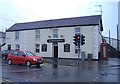
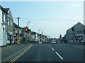
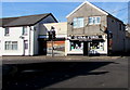
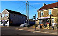
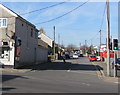
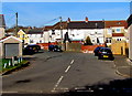
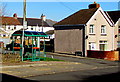
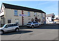
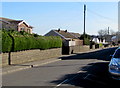
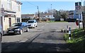
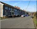
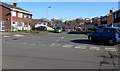
64 photos from this area
Area Information
Key information about the CF82 8HL including its size, population, and administrative classification.
- Area Type
- Postcode
- Area Size
- 1.6 hectares
- Population
- 1386
- Population Density
- 2214 people/km²
House Prices in CF82 8HL
29
Properties
£194,814
Average Sold Price
£84,000
Lowest Price
£387,500
Highest Price
Showing 29 properties
| Address | Type | Beds | Baths | Last Sale Price | Last Sale Date | |
|---|---|---|---|---|---|---|
| 25 Paxton Close, Penpedairheol, CF82 8HL | house | - | - | £307,500 | Dec 2023 | |
| 20 Paxton Close, Penpedairheol, CF82 8HL | Semi-detached | 4 | 1 | £227,000 | Apr 2023 | |
| 5 Paxton Close, Penpedairheol, CF82 8HL | Detached | 3 | 1 | £240,000 | Apr 2023 | |
| 9 Paxton Close, Penpedairheol, CF82 8HL | Detached | 4 | 1 | £387,500 | Apr 2023 | |
| 10 Paxton Close, Penpedairheol, CF82 8HL | Retail | 3 | 1 | £200,000 | Jun 2022 | |
| 3 Paxton Close, Penpedairheol, CF82 8HL | house | - | - | £140,000 | Jan 2020 | |
| 1 Paxton Close, Penpedairheol, CF82 8HL | Semi-detached | 4 | 1 | £147,000 | Jul 2017 | |
| 13 Paxton Close, Penpedairheol, CF82 8HL | Detached | - | - | £142,000 | Apr 2008 | |
| 6 Paxton Close, Penpedairheol, CF82 8HL | Semi-detached | - | - | £123,000 | Aug 2006 | |
| 7 Paxton Close, Penpedairheol, CF82 8HL | Detached | - | - | £144,950 | Jul 2005 |
Page 1 of 3
Energy Efficiency in CF82 8HL
Amenities
Schools
| Rank | School | Type | Entry gender | Ages |
|---|
Explore more schools in this area
Go to Schools tabDemographics
Household Size
Two person
most common
Accommodation Type
Houses
most common
Tenure
86
majority
Ethnic Group
White
most common
Religion
N/A
most common
Household Composition
N/A
most common
Age
47
median
Adults (30-64 years)
most common
Household Deprivation
N/A
with no deprivation
NS-SEC
34
in Lower managerial occupations
Explore more demographic insights in this area
Go to Demographics tabPlanning
Planning Constraints
- Flood RiskPremium
- Ramsar Wetland SitesPremium
- Area of Outstanding Natural BeautyPremium
- Protected Nature ReservePremium
- Protected WoodlandPremium
- Crime RiskPremium