Area Overview for CF81 9FH
Photos of CF81 9FH
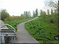
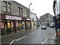
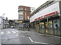
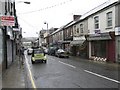
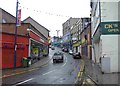

100 photos from this area
Area Information
Key information about the CF81 9FH including its size, population, and administrative classification.
- Area Type
- Postcode
- Area Size
- 1.4 hectares
- Population
- 2172
- Population Density
- 1533 people/km²
House Prices in CF81 9FH
36
Properties
£85,348
Average Sold Price
£18,500
Lowest Price
£160,000
Highest Price
Showing 36 properties
| Address | Type | Beds | Baths | Last Sale Price | Last Sale Date | |
|---|---|---|---|---|---|---|
| 170 Commercial Street, Aberbargoed, CF81 9FH | Terraced | 3 | - | £160,000 | Jun 2023 | |
| 152 Commercial Street, Aberbargoed, CF81 9FH | house | - | - | £150,000 | May 2023 | |
| 118 Commercial Street, Aberbargoed, CF81 9FH | house | - | - | £125,000 | Dec 2022 | |
| 176 Commercial Street, Aberbargoed, CF81 9FH | Flat | - | - | £103,000 | Nov 2020 | |
| 172 Commercial Street, Aberbargoed, CF81 9FH | Terraced | 3 | 1 | £58,000 | Oct 2019 | |
| 148 Commercial Street, Aberbargoed, CF81 9FH | house | - | - | £75,000 | Mar 2018 | |
| 178 Commercial Street, Aberbargoed, CF81 9FH | house | - | - | £88,000 | Mar 2018 | |
| 128 Commercial Street, Aberbargoed, CF81 9FH | Terraced | - | - | £60,000 | Jan 2016 | |
| 138 Commercial Street, Aberbargoed, CF81 9FH | house | - | - | £100,000 | Oct 2012 | |
| 174 Commercial Street, Aberbargoed, CF81 9FH | Terraced | 4 | 1 | £85,715 | Oct 2011 |
Page 1 of 4
Energy Efficiency in CF81 9FH
Amenities
Schools
| Rank | School | Type | Entry gender | Ages |
|---|
Explore more schools in this area
Go to Schools tabDemographics
Household Size
Two person
most common
Accommodation Type
Houses
most common
Tenure
54
majority
Ethnic Group
White
most common
Religion
N/A
most common
Household Composition
N/A
most common
Age
47
median
Adults (30-64 years)
most common
Household Deprivation
N/A
with no deprivation
NS-SEC
17
in Lower managerial occupations
Explore more demographic insights in this area
Go to Demographics tabPlanning
Planning Constraints
- Flood RiskPremium
- Ramsar Wetland SitesPremium
- Area of Outstanding Natural BeautyPremium
- Protected Nature ReservePremium
- Protected WoodlandPremium
- Crime RiskPremium