Area Overview for CF15 7UP
Photos of CF15 7UP
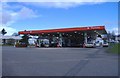
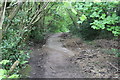
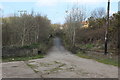
![Caerphilly Garden Centre [1] in CF15 7UP](https://images.propbar.co.uk/images/geograph/17/56/1756281_120.jpg)
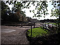
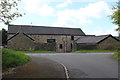
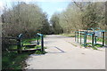
![Caerphilly Garden Centre [2] in CF15 7UP](https://images.propbar.co.uk/images/geograph/17/56/1756292_120.jpg)
29 photos from this area
Area Information
Key information about the CF15 7UP including its size, population, and administrative classification.
- Area Type
- Postcode
- Area Size
- 8.5 hectares
- Population
- 2792
- Population Density
- 1264 people/km²
House Prices in CF15 7UP
4
Properties
£585,000
Average Sold Price
£330,000
Lowest Price
£975,000
Highest Price
Showing 4 properties
| Address | Type | Beds | Baths | Last Sale Price | Last Sale Date | |
|---|---|---|---|---|---|---|
| Carreg Llwyd, Gypsy Lane, Groeswen, CF15 7UP | Detached | 4 | 4 | £975,000 | Nov 2025 | |
| Llwyn Cae Bungalow, Gypsy Lane, Groeswen, CF15 7UP | Bungalow | 2 | 1 | £330,000 | Dec 2018 | |
| The Brambles, Gypsy Lane, Groeswen, CF15 7UP | Bungalow | - | - | £450,000 | Oct 2006 | |
| Gypsy Cottage, The Brambles, Gypsy Lane, Groeswen, CF15 7UP | Flat | - | - | - | - |
Energy Efficiency in CF15 7UP
Amenities
Schools
| Rank | School | Type | Entry gender | Ages |
|---|
Explore more schools in this area
Go to Schools tabDemographics
Household Size
Family (3-5 people)
most common
Accommodation Type
Houses
most common
Tenure
74
majority
Ethnic Group
White
most common
Religion
N/A
most common
Household Composition
N/A
most common
Age
47
median
Adults (30-64 years)
most common
Household Deprivation
N/A
with no deprivation
NS-SEC
44
in Lower managerial occupations
Explore more demographic insights in this area
Go to Demographics tabPlanning
Planning Constraints
- Flood RiskPremium
- Ramsar Wetland SitesPremium
- Area of Outstanding Natural BeautyPremium
- Protected Nature ReservePremium
- Crime RiskPremium