Area Overview for CF83 2RL
Photos of CF83 2RL
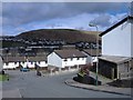
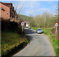
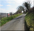
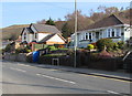
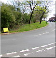
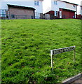
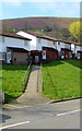
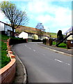
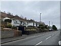
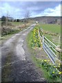
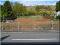
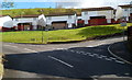
19 photos from this area
Area Information
Key information about the CF83 2RL including its size, population, and administrative classification.
- Area Type
- Postcode
- Area Size
- 1.3 km²
- Population
- 1443
- Population Density
- 353 people/km²
House Prices in CF83 2RL
15
Properties
£260,690
Average Sold Price
£70,000
Lowest Price
£525,000
Highest Price
Showing 15 properties
| Address | Type | Beds | Baths | Last Sale Price | Last Sale Date | |
|---|---|---|---|---|---|---|
| Plymouth House, 0 , Caerphilly, CF83 2RL | Detached | 5 | 1 | £525,000 | May 2017 | |
| 4 White Cross Lane, Caerphilly, CF83 2RL | Semi-detached | 3 | 2 | £163,500 | Mar 2017 | |
| Ty Newydd Barn, Mountain Road Abertridwr To Hendredenny Park, Hendredenny, Caerphilly, CF83 2RL | Bungalow | - | - | £423,900 | Jun 2010 | |
| Belmont, 1 White Cross Lane, Hendredenny, Caerphilly, CF83 2RL | Semi-detached | 3 | 1 | £121,050 | Feb 2004 | |
| Woodlands, 5 White Cross Lane, Hendredenny, Caerphilly, CF83 2RL | Detached | - | - | £70,000 | Sep 1998 | |
| Sunningdale, 3 White Cross Lane, Hendredenny, Caerphilly, CF83 2RL | Semi-detached | 3 | 1 | - | - | |
| Living Quarters, Angel Inn, White Cross Lane, Hendredenny, Caerphilly, CF83 2RL | Flat | - | - | - | - | |
| Flat B, Angel Inn, White Cross Lane, Hendredenny, Caerphilly, CF83 2RL | Flat | - | - | - | - | |
| Haytor, 2 White Cross Lane, Hendredenny, Caerphilly, CF83 2RL | Semi-detached | - | - | - | - | |
| Ty Siriol, Hendredenny Uchaf Farm, Mountain Road Abertridwr To Hendredenny Park, Hendredenny, Caerphilly, CF83 2RL | Detached | - | - | - | - |
Page 1 of 2
Energy Efficiency in CF83 2RL
Amenities
Schools
| Rank | School | Type | Entry gender | Ages |
|---|
Explore more schools in this area
Go to Schools tabDemographics
Household Size
Two person
most common
Accommodation Type
Houses
most common
Tenure
69
majority
Ethnic Group
White
most common
Religion
N/A
most common
Household Composition
N/A
most common
Age
47
median
Adults (30-64 years)
most common
Household Deprivation
N/A
with no deprivation
NS-SEC
20
in Lower managerial occupations
Explore more demographic insights in this area
Go to Demographics tabPlanning
Planning Constraints
- Flood RiskPremium
- Ramsar Wetland SitesPremium
- Area of Outstanding Natural BeautyPremium
- Protected Nature ReservePremium
- Protected WoodlandPremium
- Crime RiskPremium