Area Overview for Newcastle Higher Community
Photos of Newcastle Higher Community
Area Information
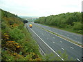
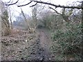
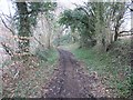
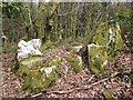
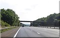
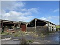
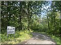
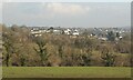
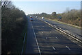
Newcastle Higher Community is a distinct civil parish in Bridgend County Borough, south Wales, covering an area of 6.6 km². This neighbourhood straddles the M4 motorway and is situated north-west of the Bridgend town centre. The area comprises the townships of Pen-y-fai and Aberkenfig, falling within the Pen-y-bont ar Ogwr unitary authority. Its history dates back to the medieval period, with a Norman earthwork castle first recorded in 1106 on Newcastle Hill to control the crossing of the Ogmore River. The site was later refortified in stone during the 1180s by Henry II and functioned as a Turbervill manor. You will find notable landmarks such as the Grade II* listed Newcastle Castle ruins overlooking the valley. In Pen-y-fai, you can visit Glanrhyd Hospital, formerly the Glamorganshire Lunatic Asylum, alongside other heritage sites like the Court Colman Hotel and Smyrna Baptist Chapel. The community council now governs the area, which includes the wards of Aberkenfig and Pen-y-fai. Located near Bridgend station, where Brunel's South Wales Railway opened in 1850, the area offers practical access to wider rail links while retaining its rural character. Living in Newcastle Higher provides a connection to this rich local heritage without the urban density of the main town.
- Area Type
- Parish
- Area Size
- 6.6 km²
- Population
- Not available
- Population Density
- Not available
Demographics
The demographic profile of Newcastle Higher reveals a settled community with a median age of 70 years. This figure indicates that the population skews significantly towards older residents. The area records a high level of home ownership, with 85% of households owning their property outright or with mortgage. This metric suggests a stable resident base rather than a transient rental market. The large proportion of owner-occupiers often points to individuals who have lived in the area for extended periods. While specific data on household composition and accommodation types are not detailed in the current records, the high ownership rate implies long-term residency. The area also shows a majority home ownership figure, reinforcing the idea of a traditional residential community. You should expect to find fewer young families entering the market unless specific housing options cater to their needs. The high median age for Newcastle Higher contrasts sharply with many urban centres in Wales. This age profile influences local services and the general pace of daily life. Residents benefit from a stable environment where neighbours often know each other well. The demographic reality means this is a neighbourhood designed for established homes rather than new urban developments.
Household Size
Accommodation Type
Tenure
Ethnic Group
Religion
Household Composition
Age
Household Deprivation
NS-SEC
Explore more demographic insights in this area
Go to Demographics tabPlanning
Planning Constraints
- Flood RiskPremium
- Ramsar Wetland SitesPremium
- Area of Outstanding Natural BeautyPremium
- Protected Nature ReservePremium
- Protected WoodlandPremium
- Crime RiskPremium