Area Overview for Llangynwyd Middle Community
Photos of Llangynwyd Middle Community
Area Information
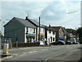
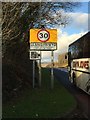
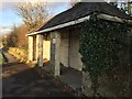
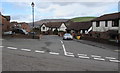
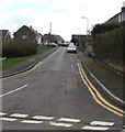
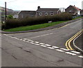
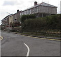
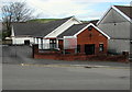
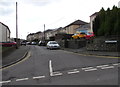
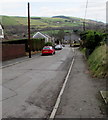
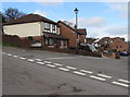
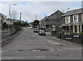
Living in Llangynwyd Middle Community offers a distinctly different pace from the fast-paced growth found in much of the UK. This civil parish sits in Bridgend County Borough, south Wales, covering a total area of 13.5 km². The landscape is defined by the northern part of the old parish of Llangynwyd, which was reorganised by the government in 1974. You are surrounded by hilly farmland that remains sparsely populated, yet the core villages of Llangynwyd and Cwmfelin hold historic significance. The River Llynfi flows through this land, running alongside the A4063, which provides the vital arterial link between Maesteg and Bridgend. While the majority of the community consists of open, rural terrain, the village core offers a focal point for local life. St Cynwyd's Church anchors the settlement, standing as a testament to the area's 14th-century origins and its enduring Welsh literary tradition. You live in a setting where history is physically present in the form of the medieval castle ruins and the church's square western tower. Daily life here blends rural openness with accessible settlement amenities. The community feels true to its character as a parish rather than a sprawling urban zone, preserving the quiet dignity of its historic roots while maintaining practical connectivity to nearby towns.
- Area Type
- Parish
- Area Size
- 13.5 km²
- Population
- Not available
- Population Density
- Not available
Demographics
The demographic profile of Llangynwyd Middle Community presents a clear picture of an established settlement with a stable population structure. The median age for residents is 70, indicating a community where a significant portion of the population resides in older age brackets. Most residents fall into the 'Age: Total' category, reflecting a comprehensive census count rather than a youth-heavy demographic. This age profile suggests a community less driven by young families moving into starter homes and more settled by long-term residents. Home ownership stands at 78%, a figure that defines the character of local property transactions and neighbourhood stability. The area does not rely on a rental market; instead, the vast majority of households own their homes outright. Accommodation data shows a total count that aligns with the housing stock being predominantly freehold rather than leasehold or rented units. Though specific details on predominant ethnic groups and religious affiliations are not detailed in the current census breakdown, the area maintains the cultural heritage typical of Welsh parishes. The high rate of home ownership combined with the older age profile creates a neighbourhood where community cohesion is likely built on decades, if not centuries, of shared history. You will find a resident base that values stability, evidenced by the collective effort to maintain old churches and historic sites.
Household Size
Accommodation Type
Tenure
Ethnic Group
Religion
Household Composition
Age
Household Deprivation
NS-SEC
Explore more demographic insights in this area
Go to Demographics tabPlanning
Planning Constraints
- Flood RiskPremium
- Ramsar Wetland SitesPremium
- Area of Outstanding Natural BeautyPremium
- Protected Nature ReservePremium
- Protected WoodlandPremium
- Crime RiskPremium