Area Overview for Laleston Community
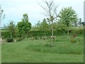
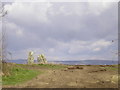
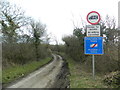
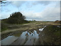
Photos of Laleston Community
Area Information
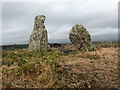
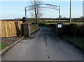
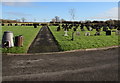
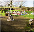
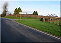
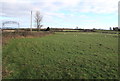
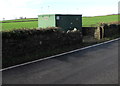
Laleston Community stands as a distinct civil parish within Bridgend County Borough, south Wales. You find this village located directly west of Bridgend town centre, situated at coordinates 51.513307, -3.606753. The area covers 10.3 km² and houses a population of 1876 residents. Your daily life in Laleston will involve navigating a landscape defined by the M4 motorway to the west and north-west, while the A48 runs to the south-east towards Bridgend. This strategic positioning allows easy access to major transport arteries. The community itself incorporates several smaller settlements including Bryntirion, Cefn Glas, Tythegston and Broadlands. These distinct villages make up a larger parish with historical roots tracing back to the Norman Lageles family. You will walk past St David's Church, featuring elements from the 13th and 14th centuries, or admire the Great House, built in the early 16th century. The area offers a quiet residential feel typical of its demographic profile. Living in Laleston Community means enjoying a setting where history meets modern accessibility. The boundaries established by major roads create a contained village atmosphere despite the proximity to significant infrastructure. You can explore local sites such as the Ancient Well, which remains best preserved in Wales, or visit the renovated Old Pound. Your everyday experience involves a balance of rural history and contemporary Welsh life within a defined and accessible administrative area.
- Area Type
- Parish
- Area Size
- 10.3 km²
- Population
- 1876
- Population Density
- 183 people/km²
Demographics
The demographic profile of Laleston Community reveals a settlement with a clear generational character. You will find that the median age is 70 years old. This statistic indicates an older population compared to national averages for many urban areas. The most common age range breaks down as Age: Total, reflecting the wide spread within this elderly demographic. A significant portion of the community owns their homes, with a home ownership rate of 74%. This high level of ownership suggests long-term residents who have established roots in the area. Households in Laleston demonstrate varied compositions, though specific breakdowns are not detailed. Accommodation types mirror this traditional ownership pattern, resulting in a stock dominated by owner-occupied properties rather than rental units. The population density stands at 183 people per km². This figure confirms a moderately dense settlement where houses are likely close to one another. You do not need to worry about housing shortages given the existing stock levels. The ethnic makeup and religious affiliations reflect the broader population of south Wales, with no single group dominating overwhelmingly. Living in Laleston Community, you join a neighbourhood where families and older residents share local facilities. The high ownership rate means you are more likely to find stability in the area's social fabric.
Household Size
Accommodation Type
Tenure
Ethnic Group
Religion
Household Composition
Age
Household Deprivation
NS-SEC
Explore more demographic insights in this area
Go to Demographics tabPlanning
Planning Constraints
- Flood RiskPremium
- Ramsar Wetland SitesPremium
- Area of Outstanding Natural BeautyPremium
- Protected Nature ReservePremium
- Protected WoodlandPremium
- Crime RiskPremium