Area Overview for CF35 6XD
Photos of CF35 6XD
Area Information
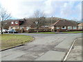
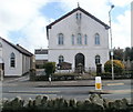
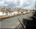
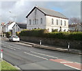
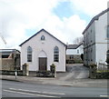
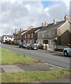
Living in CF35 6XD means being part of a small, tightly knit residential cluster in the county borough of Bridgend, Wales. With a population of 2,235, this area reflects the character of Pencoed, a town shaped by its history as a commuter hub for the South Wales Valleys’ industrial workforce. Situated on the Ewenny River and near the M4 motorway, CF35 6XD benefits from strategic connectivity to Bridgend and beyond. The area’s residential focus is evident in its high home ownership rate and prevalence of family homes. Daily life here blends practicality with historical roots, from the 1856 Pencoed Railway Station to the 1775 Salem Chapel. Proximity to Bridgend’s amenities and the South Wales countryside offers a balance of urban convenience and natural access. While the town itself is not a tourist destination, its position as a residential node serving broader industrial and economic activity in Bridgend Borough ensures a steady, stable community. The area’s compact size means residents are close to essential services, though its small scale limits the range of local facilities compared to larger towns.
- Area Type
- Postcode
- Area Size
- Not available
- Population
- 2235
- Population Density
- 2376 people/km²
The property market in CF35 6XD is dominated by owner-occupied homes, with 92% of properties in private hands. This high rate of home ownership suggests a stable, long-term resident base with little reliance on rental housing. The accommodation type is exclusively houses, indicating a lack of high-density development or flats. This makes the area more suited to families or individuals seeking single-family homes rather than investors or renters. Given the small size of the postcode area, the housing stock is limited, and buyers may need to consider nearby suburbs or towns within Bridgend Borough for more options. The prevalence of houses also implies that properties here are likely to be larger than average, with gardens or outdoor space. However, the lack of commercial or industrial land use means the area is not a hub for speculative development or new builds. For buyers, this means a focus on existing, well-established properties rather than new construction.
House Prices in CF35 6XD
No properties found in this postcode.
Energy Efficiency in CF35 6XD
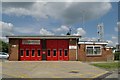
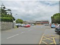
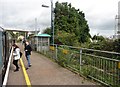
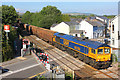
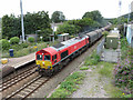
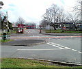
Residents of CF35 6XD have access to essential retail amenities within practical reach, including Co-op Pencoed, Tesco Pencoed, and Spar, which provide everyday shopping needs. The area’s rail network, with five stations such as Pencoed and Wildmill, offers convenient commuting options to Bridgend and beyond. While the postcode itself is a small residential cluster, its proximity to Bridgend means residents can access the town’s broader amenities, including cultural attractions, parks, and leisure facilities. The character of daily life here is shaped by its role as a commuter town, with a focus on practicality and connectivity. The presence of historical sites like Salem Chapel and Pencoed House Estate adds a layer of local interest, though the area is not a tourist destination. For those prioritising convenience, the combination of retail, rail, and motorway access ensures a functional lifestyle, albeit with limited local entertainment options compared to larger towns.
Amenities
Schools
| Rank | School | Type | Entry gender | Ages |
|---|
Explore more schools in this area
Go to Schools tabDemographics
The community in CF35 6XD is predominantly composed of adults aged 30–64, with a median age of 47. This suggests a mature, established population, likely centred around family households and long-term residents. Home ownership is exceptionally high at 92%, indicating a stable, settled community with limited rental activity. The accommodation type is exclusively houses, reflecting a preference for single-family dwellings over flats or apartments. The predominant ethnic group is White, aligning with broader demographic trends in the region. The absence of detailed deprivation data means no specific conclusions can be drawn about economic hardship, but the high home ownership and age profile suggest a relatively secure, middle-income demographic. This profile implies a community focused on long-term residency, with limited turnover of properties or residents. The area’s small size and residential character mean its demographics are unlikely to shift significantly in the short term.
Household Size
Accommodation Type
Tenure
Ethnic Group
Religion
Household Composition
Age
Household Deprivation
NS-SEC
Explore more demographic insights in this area
Go to Demographics tabPlanning
Planning Constraints
- Flood RiskPremium
- Ramsar Wetland SitesPremium
- Area of Outstanding Natural BeautyPremium
- Protected Nature ReservePremium
- Protected WoodlandPremium
- Crime RiskPremium