Area Overview for CF35 6SP
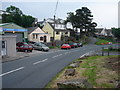
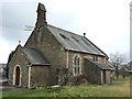
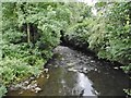
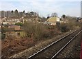
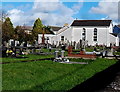
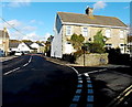
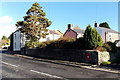
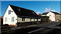
Photos of CF35 6SP
Area Information
CF35 6SP represents a specific residential cluster within the wider community of Pencoed, located in the county borough of Bridgend, Wales. This small area spans 5,652 square metres and supports a population of 1,722 residents. The settlement sits on the Ewenny River and straddles the M4 motorway, placing it north-east of Bridgend town. Historically, the name derives from Welsh words for "head of the wood," reflecting a past when the location was predominantly wooded. While the broader Pencoed town has a population exceeding 10,000, this postcode cluster functions as a core part of a heavily urbanised community that developed in the late nineteenth century. Residents live in an environment that transitioned from agricultural roots to a residential dormitory town serving industrial workers. The area now functions primarily as a modern residential locality rather than a tourist destination. You will find a tightly knit neighbourhood where contemporary life balances access to the South Wales coast and countryside with proximity to urban employment centres. The postcode area offers a distinct slice of life characterised by established housing and strong local connectivity. For those seeking homes in CF35 6SP, the area provides a settled residential context within a town known for its historical significance and strategic transport links.
- Area Type
- Postcode
- Area Size
- 5652 m²
- Population
- 1722
- Population Density
- 462 people/km²
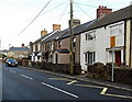
Homes in CF35 6SP are overwhelmingly detached houses, reflecting the area's long history as a family-oriented residential suburb. The accommodation type is exclusively houses, with no mention of flats or apartments within the provided data for this specific postcode. This suggests a landscape of single-family properties suited to families or those seeking space and privacy. With a home ownership rate of 74%, the market here is predominantly owner-occupied rather than driven by private renting. This high percentage of ownership indicates that residents have likely made significant local investments over many years. You are looking primarily at established stock rather than speculative new-build developments. The area comprises 5,652 square metres, suggesting a compact but sufficient zone for housing 1,722 people. For buyers considering this location, the housing stock offers a practical, family-centric environment. The character of the properties aligns with the town's evolution from an industrial dormitory to a modern residential locality. When purchasing in CF35 6SP, you enter a market defined by stability and permanent residence.
House Prices in CF35 6SP
Showing 1 properties
| Address | Type | Beds | Baths | Last Sale Price | Last Sale Date | |
|---|---|---|---|---|---|---|
| Islawen Farm, Islawen Meadows, Pencoed, Bridgend, CF35 6SP | Detached | - | - | - | - |
Energy Efficiency in CF35 6SP
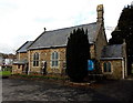
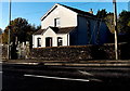
Daily life for those living in CF35 6SP benefits from a dense network of amenities within practical reach. Retail options are well-serviced, with five notable venues including Co-op Pencoed, Tesco Pencoed, and Spar. These supermarkets provide ample choice for weekly shopping and essential household needs. Transport options are equally comprehensive, with five rail stations readily accessible to support daily commutes. You can choose from Pencoed Railway Station, Llanharan Railway Station, and Wildmill Railway Station depending on your destination. The broader Pencoed environment offers a mix of historic and modern conveniences. Historic landmarks like Salem Chapel and Tregroes House provide cultural interest, while the proximity to the M4 motorway ensures swift travel to coastal attractions and the South Wales valleys. The area functions as a practical residential hub where you can access quality groceries and transport links without needing to travel far. When looking at the local estate, you find a balance between rural heritage and urban utility that suits busy households.
Amenities
Schools
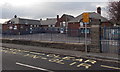
Heol Y Cyw Primary School stands as the nearest educational facility to CF35 6SP. This institution serves the local community with a designation noted as "other" in the available records, distinguishing it from independent or secondary institutions within the immediate vicinity. The presence of a primary school indicates that young families are an integral part of the demographic profile in this postcode. While specific Ofsted ratings are not included in the current documentation, the existence of a primary school confirms access to basic education for school-aged children living in the area. For families considering living in CF35 6SP, having a local primary option is a key factor in decision-making. The school's proximity ensures that daily commutes to education are manageable for parents working in the Bridgend Borough or the wider South Wales Valleys. This educational resource anchors the residential nature of the neighbourhood, supporting the high home ownership rate observed in the wider community.
| Rank | School | Type | Entry gender | Ages |
|---|
Explore more schools in this area
Go to Schools tabDemographics
The community within CF35 6SP is defined by stability and a mature age profile. The median age for residents is 47 years, with adults aged between 30 and 64 years comprising the most common age range. This demographic skew suggests a population that has settled into long-term residences rather than a transient workforce. Home ownership is high at 74%, indicating that the majority of households have purchased their properties. This level of ownership typically correlates with greater investment in local amenities and a stronger sense of community cohesion. You will find that the predominant ethnic group in the area is White, which aligns with the broader region's historical growth patterns. Families with grown children or retirees often dominate the housing stock, driving demand for larger properties well-served by the local infrastructure. The high concentration of owner-occupied homes creates a quiet, established atmosphere compared to newer commuter developments. When living in CF35 6SP, you join a community where the residential character is deeply embedded in the local landscape. This demographic profile supports local businesses that cater to established households seeking reliability and permanence in their daily lives.
Household Size
Accommodation Type
Tenure
Ethnic Group
Religion
Household Composition
Age
Household Deprivation
NS-SEC
Explore more demographic insights in this area
Go to Demographics tabPlanning
Planning Constraints
- Flood RiskPremium
- Ramsar Wetland SitesPremium
- Area of Outstanding Natural BeautyPremium
- Protected Nature ReservePremium
- Protected WoodlandPremium
- Crime RiskPremium